You are here: Home > Network List > IU - Global Seismograph Network (GSN - IRIS/USGS) Stations List
> Station XMAS Kiritimati Island, Republic of Kiribati > Earthquake Result Viewer
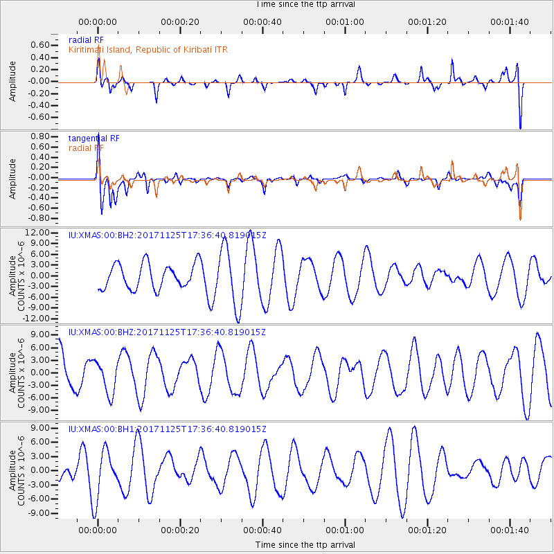
XMAS Kiritimati Island, Republic of Kiribati - Earthquake Result Viewer
*The percent match for this event was below the threshold and hence no stack was calculated.
| Earthquake location: |
Vanuatu Islands Region |
| Earthquake latitude/longitude: |
-20.6/172.6 |
| Earthquake time(UTC): |
2017/11/25 (329) 17:30:01 GMT |
| Earthquake Depth: |
10 km |
| Earthquake Magnitude: |
5.8 Mww |
| Earthquake Catalog/Contributor: |
NEIC PDE/us |
|
| Network: |
IU Global Seismograph Network (GSN - IRIS/USGS) |
| Station: |
XMAS Kiritimati Island, Republic of Kiribati |
| Lat/Lon: |
2.04 N/157.45 W |
| Elevation: |
20 m |
|
| Distance: |
37.0 deg |
| Az: |
56.055 deg |
| Baz: |
231.038 deg |
| Ray Param: |
$rayparam |
*The percent match for this event was below the threshold and hence was not used in the summary stack. |
|
| Radial Match: |
69.73098 % |
| Radial Bump: |
400 |
| Transverse Match: |
62.544292 % |
| Transverse Bump: |
400 |
| SOD ConfigId: |
2973751 |
| Insert Time: |
2018-10-09 02:57:24.519 +0000 |
| GWidth: |
2.5 |
| Max Bumps: |
400 |
| Tol: |
0.001 |
|
Signal To Noise
| Channel | StoN | STA | LTA |
| IU:XMAS:00:BHZ:20171125T17:36:40.819015Z | 0.8772584 | 3.946221E-6 | 4.4983562E-6 |
| IU:XMAS:00:BH1:20171125T17:36:40.819015Z | 2.8997412 | 4.9037308E-6 | 1.6910926E-6 |
| IU:XMAS:00:BH2:20171125T17:36:40.819015Z | 2.497589 | 8.371013E-6 | 3.3516371E-6 |
| Arrivals |
| Ps | |
| PpPs | |
| PsPs/PpSs | |


