You are here: Home > Network List > US - United States National Seismic Network Stations List
> Station EGMT Eagleton, Montana, USA > Earthquake Result Viewer
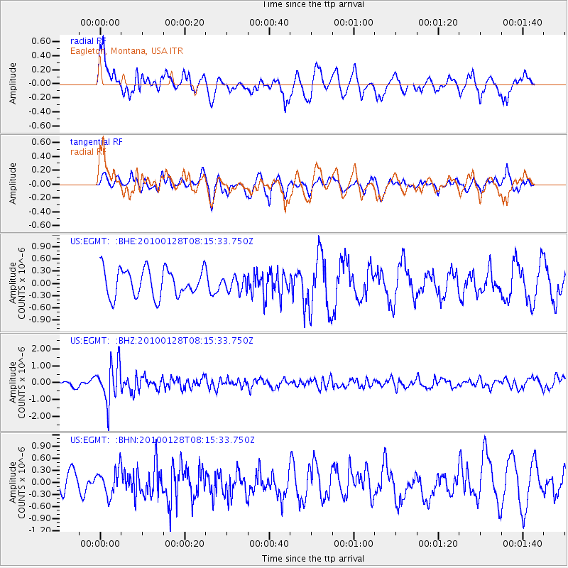
EGMT Eagleton, Montana, USA - Earthquake Result Viewer
*The percent match for this event was below the threshold and hence no stack was calculated.
| Earthquake location: |
Jujuy Province, Argentina |
| Earthquake latitude/longitude: |
-23.4/-66.7 |
| Earthquake time(UTC): |
2010/01/28 (028) 08:04:14 GMT |
| Earthquake Depth: |
208 km |
| Earthquake Magnitude: |
5.8 MB, 5.9 MW, 5.9 MW |
| Earthquake Catalog/Contributor: |
WHDF/NEIC |
|
| Network: |
US United States National Seismic Network |
| Station: |
EGMT Eagleton, Montana, USA |
| Lat/Lon: |
48.02 N/109.75 W |
| Elevation: |
1055 m |
|
| Distance: |
80.9 deg |
| Az: |
332.35 deg |
| Baz: |
140.556 deg |
| Ray Param: |
$rayparam |
*The percent match for this event was below the threshold and hence was not used in the summary stack. |
|
| Radial Match: |
68.83918 % |
| Radial Bump: |
400 |
| Transverse Match: |
51.71006 % |
| Transverse Bump: |
400 |
| SOD ConfigId: |
296938 |
| Insert Time: |
2010-04-07 01:08:39.653 +0000 |
| GWidth: |
2.5 |
| Max Bumps: |
400 |
| Tol: |
0.001 |
|
Signal To Noise
| Channel | StoN | STA | LTA |
| US:EGMT: :BHZ:20100128T08:15:33.750Z | 3.322473 | 1.1487383E-6 | 3.45748E-7 |
| US:EGMT: :BHN:20100128T08:15:33.750Z | 0.8877279 | 3.2912226E-7 | 3.7074676E-7 |
| US:EGMT: :BHE:20100128T08:15:33.750Z | 0.5369495 | 1.8130841E-7 | 3.3766378E-7 |
| Arrivals |
| Ps | |
| PpPs | |
| PsPs/PpSs | |


