You are here: Home > Network List > UW - Pacific Northwest Regional Seismic Network Stations List
> Station FISH Seaside, OR, USA > Earthquake Result Viewer
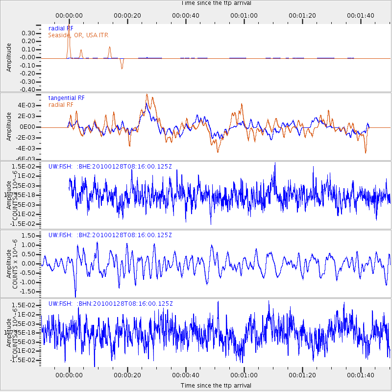
FISH Seaside, OR, USA - Earthquake Result Viewer
*The percent match for this event was below the threshold and hence no stack was calculated.
| Earthquake location: |
Jujuy Province, Argentina |
| Earthquake latitude/longitude: |
-23.4/-66.7 |
| Earthquake time(UTC): |
2010/01/28 (028) 08:04:14 GMT |
| Earthquake Depth: |
208 km |
| Earthquake Magnitude: |
5.8 MB, 5.9 MW, 5.9 MW |
| Earthquake Catalog/Contributor: |
WHDF/NEIC |
|
| Network: |
UW Pacific Northwest Regional Seismic Network |
| Station: |
FISH Seaside, OR, USA |
| Lat/Lon: |
45.93 N/123.56 W |
| Elevation: |
325 m |
|
| Distance: |
86.1 deg |
| Az: |
324.148 deg |
| Baz: |
129.536 deg |
| Ray Param: |
$rayparam |
*The percent match for this event was below the threshold and hence was not used in the summary stack. |
|
| Radial Match: |
41.306725 % |
| Radial Bump: |
400 |
| Transverse Match: |
42.719112 % |
| Transverse Bump: |
400 |
| SOD ConfigId: |
296938 |
| Insert Time: |
2010-04-07 01:09:41.522 +0000 |
| GWidth: |
2.5 |
| Max Bumps: |
400 |
| Tol: |
0.001 |
|
Signal To Noise
| Channel | StoN | STA | LTA |
| UW:FISH: :BHZ:20100128T08:16:00.125Z | 2.846219 | 6.1405484E-7 | 2.1574407E-7 |
| UW:FISH: :BHN:20100128T08:16:00.125Z | 1.0753855 | 5.4158416E-9 | 5.036186E-9 |
| UW:FISH: :BHE:20100128T08:16:00.125Z | 0.89642537 | 4.0376364E-9 | 4.5041526E-9 |
| Arrivals |
| Ps | |
| PpPs | |
| PsPs/PpSs | |


