You are here: Home > Network List > UW - Pacific Northwest Regional Seismic Network Stations List
> Station LEBA Lebam, WA, USA > Earthquake Result Viewer
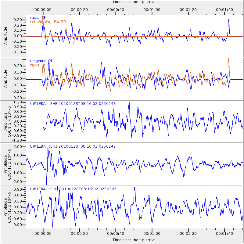
LEBA Lebam, WA, USA - Earthquake Result Viewer
*The percent match for this event was below the threshold and hence no stack was calculated.
| Earthquake location: |
Jujuy Province, Argentina |
| Earthquake latitude/longitude: |
-23.4/-66.7 |
| Earthquake time(UTC): |
2010/01/28 (028) 08:04:14 GMT |
| Earthquake Depth: |
208 km |
| Earthquake Magnitude: |
5.8 MB, 5.9 MW, 5.9 MW |
| Earthquake Catalog/Contributor: |
WHDF/NEIC |
|
| Network: |
UW Pacific Northwest Regional Seismic Network |
| Station: |
LEBA Lebam, WA, USA |
| Lat/Lon: |
46.55 N/123.56 W |
| Elevation: |
73 m |
|
| Distance: |
86.5 deg |
| Az: |
324.622 deg |
| Baz: |
129.564 deg |
| Ray Param: |
$rayparam |
*The percent match for this event was below the threshold and hence was not used in the summary stack. |
|
| Radial Match: |
56.996914 % |
| Radial Bump: |
400 |
| Transverse Match: |
56.879677 % |
| Transverse Bump: |
400 |
| SOD ConfigId: |
296938 |
| Insert Time: |
2010-04-07 01:10:25.131 +0000 |
| GWidth: |
2.5 |
| Max Bumps: |
400 |
| Tol: |
0.001 |
|
Signal To Noise
| Channel | StoN | STA | LTA |
| UW:LEBA: :BHZ:20100128T08:16:02.025024Z | 2.2240937 | 9.618594E-7 | 4.3247255E-7 |
| UW:LEBA: :BHN:20100128T08:16:02.025024Z | 1.4365299 | 4.0794606E-7 | 2.839802E-7 |
| UW:LEBA: :BHE:20100128T08:16:02.025024Z | 1.0033746 | 3.4967255E-7 | 3.484965E-7 |
| Arrivals |
| Ps | |
| PpPs | |
| PsPs/PpSs | |


