You are here: Home > Network List > TA - USArray Transportable Network (new EarthScope stations) Stations List
> Station W28A Vega, TX, USA > Earthquake Result Viewer
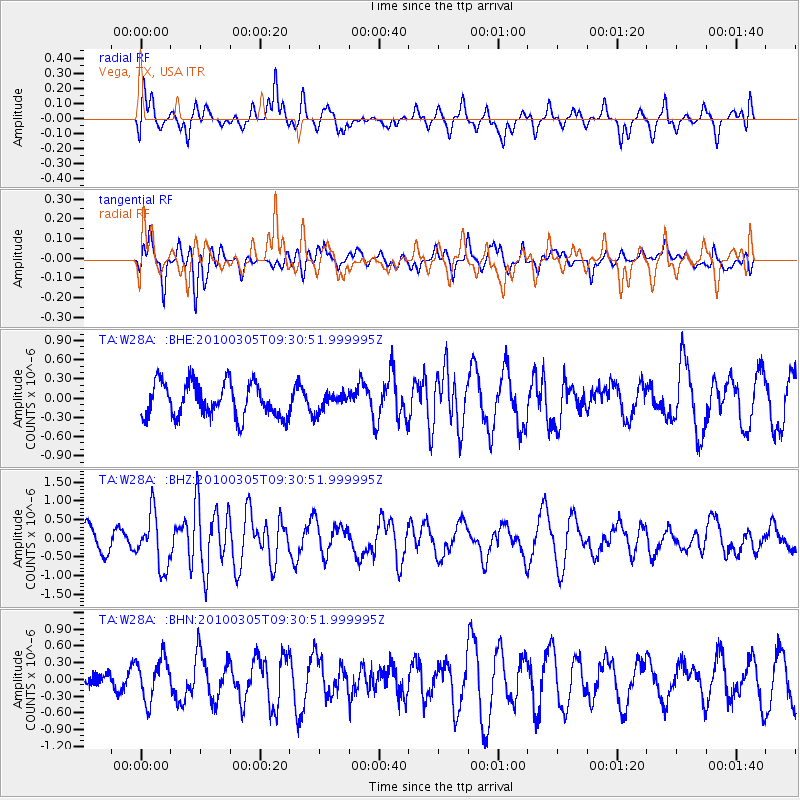
W28A Vega, TX, USA - Earthquake Result Viewer
*The percent match for this event was below the threshold and hence no stack was calculated.
| Earthquake location: |
Near Coast Of Central Chile |
| Earthquake latitude/longitude: |
-36.6/-73.2 |
| Earthquake time(UTC): |
2010/03/05 (064) 09:19:36 GMT |
| Earthquake Depth: |
30 km |
| Earthquake Magnitude: |
5.9 MB, 5.8 MS, 6.1 MW, 6.0 MW |
| Earthquake Catalog/Contributor: |
WHDF/NEIC |
|
| Network: |
TA USArray Transportable Network (new EarthScope stations) |
| Station: |
W28A Vega, TX, USA |
| Lat/Lon: |
35.26 N/102.21 W |
| Elevation: |
1156 m |
|
| Distance: |
76.4 deg |
| Az: |
335.925 deg |
| Baz: |
156.362 deg |
| Ray Param: |
$rayparam |
*The percent match for this event was below the threshold and hence was not used in the summary stack. |
|
| Radial Match: |
57.552723 % |
| Radial Bump: |
400 |
| Transverse Match: |
56.274902 % |
| Transverse Bump: |
400 |
| SOD ConfigId: |
299721 |
| Insert Time: |
2010-04-26 16:48:38.425 +0000 |
| GWidth: |
2.5 |
| Max Bumps: |
400 |
| Tol: |
0.001 |
|
Signal To Noise
| Channel | StoN | STA | LTA |
| TA:W28A: :BHZ:20100305T09:30:51.999995Z | 2.9847744 | 7.094477E-7 | 2.3768888E-7 |
| TA:W28A: :BHN:20100305T09:30:51.999995Z | 1.6526979 | 3.681539E-7 | 2.2275935E-7 |
| TA:W28A: :BHE:20100305T09:30:51.999995Z | 0.51098394 | 1.3480722E-7 | 2.6381892E-7 |
| Arrivals |
| Ps | |
| PpPs | |
| PsPs/PpSs | |


