You are here: Home > Network List > AV - Alaska Volcano Observatory Stations List
> Station SPCR Ckakachatna River, Mount Spurr, Alaska > Earthquake Result Viewer
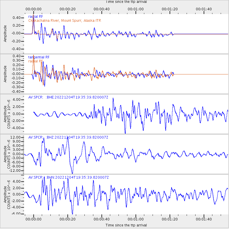
SPCR Ckakachatna River, Mount Spurr, Alaska - Earthquake Result Viewer
*The percent match for this event was below the threshold and hence no stack was calculated.
| Earthquake location: |
Samoa Islands Region |
| Earthquake latitude/longitude: |
-15.7/-172.5 |
| Earthquake time(UTC): |
2022/12/04 (338) 19:24:27 GMT |
| Earthquake Depth: |
148 km |
| Earthquake Magnitude: |
6.9 Mi |
| Earthquake Catalog/Contributor: |
NEIC PDE/at |
|
| Network: |
AV Alaska Volcano Observatory |
| Station: |
SPCR Ckakachatna River, Mount Spurr, Alaska |
| Lat/Lon: |
61.20 N/152.21 W |
| Elevation: |
984 m |
|
| Distance: |
78.3 deg |
| Az: |
9.873 deg |
| Baz: |
199.941 deg |
| Ray Param: |
$rayparam |
*The percent match for this event was below the threshold and hence was not used in the summary stack. |
|
| Radial Match: |
79.94224 % |
| Radial Bump: |
400 |
| Transverse Match: |
78.61535 % |
| Transverse Bump: |
400 |
| SOD ConfigId: |
29823551 |
| Insert Time: |
2022-12-18 19:53:31.832 +0000 |
| GWidth: |
2.5 |
| Max Bumps: |
400 |
| Tol: |
0.001 |
|
Signal To Noise
| Channel | StoN | STA | LTA |
| AV:SPCR: :BHZ:20221204T19:35:39.820007Z | 12.075054 | 4.4107674E-6 | 3.6527933E-7 |
| AV:SPCR: :BHN:20221204T19:35:39.820007Z | 3.1338499 | 1.5669335E-6 | 5.000027E-7 |
| AV:SPCR: :BHE:20221204T19:35:39.820007Z | 1.6712636 | 6.1426164E-7 | 3.6754324E-7 |
| Arrivals |
| Ps | |
| PpPs | |
| PsPs/PpSs | |


