You are here: Home > Network List > TA - USArray Transportable Network (new EarthScope stations) Stations List
> Station 531A Rocksprings, TX, USA > Earthquake Result Viewer
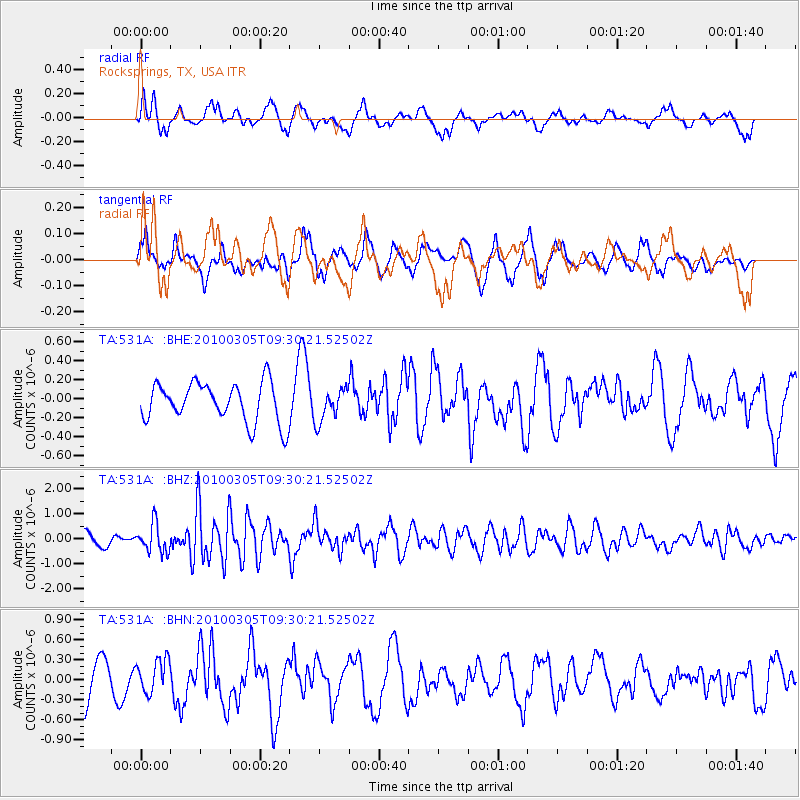
531A Rocksprings, TX, USA - Earthquake Result Viewer
*The percent match for this event was below the threshold and hence no stack was calculated.
| Earthquake location: |
Near Coast Of Central Chile |
| Earthquake latitude/longitude: |
-36.6/-73.2 |
| Earthquake time(UTC): |
2010/03/05 (064) 09:19:36 GMT |
| Earthquake Depth: |
30 km |
| Earthquake Magnitude: |
5.9 MB, 5.8 MS, 6.1 MW, 6.0 MW |
| Earthquake Catalog/Contributor: |
WHDF/NEIC |
|
| Network: |
TA USArray Transportable Network (new EarthScope stations) |
| Station: |
531A Rocksprings, TX, USA |
| Lat/Lon: |
30.16 N/100.55 W |
| Elevation: |
661 m |
|
| Distance: |
71.2 deg |
| Az: |
335.173 deg |
| Baz: |
157.046 deg |
| Ray Param: |
$rayparam |
*The percent match for this event was below the threshold and hence was not used in the summary stack. |
|
| Radial Match: |
39.809708 % |
| Radial Bump: |
400 |
| Transverse Match: |
54.64537 % |
| Transverse Bump: |
400 |
| SOD ConfigId: |
299721 |
| Insert Time: |
2010-04-26 16:49:42.804 +0000 |
| GWidth: |
2.5 |
| Max Bumps: |
400 |
| Tol: |
0.001 |
|
Signal To Noise
| Channel | StoN | STA | LTA |
| TA:531A: :BHZ:20100305T09:30:21.52502Z | 2.4559512 | 5.6292214E-7 | 2.2920737E-7 |
| TA:531A: :BHN:20100305T09:30:21.52502Z | 0.9438441 | 2.5097336E-7 | 2.6590556E-7 |
| TA:531A: :BHE:20100305T09:30:21.52502Z | 0.82909524 | 1.6978842E-7 | 2.047876E-7 |
| Arrivals |
| Ps | |
| PpPs | |
| PsPs/PpSs | |


