You are here: Home > Network List > TA - USArray Transportable Network (new EarthScope stations) Stations List
> Station H28A Mission Ridge, SD, USA > Earthquake Result Viewer
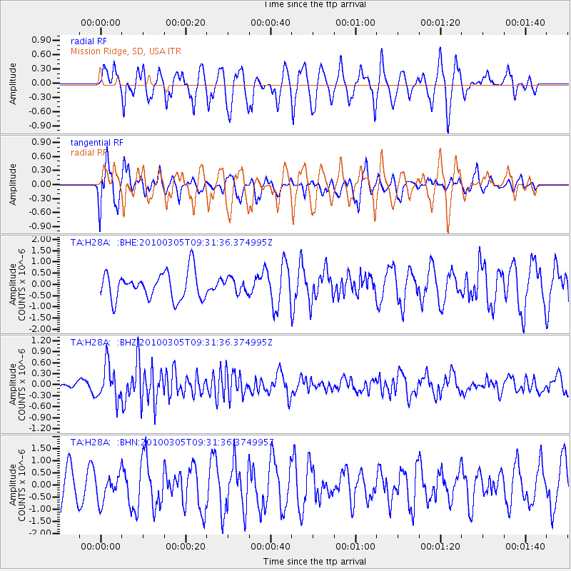
H28A Mission Ridge, SD, USA - Earthquake Result Viewer
*The percent match for this event was below the threshold and hence no stack was calculated.
| Earthquake location: |
Near Coast Of Central Chile |
| Earthquake latitude/longitude: |
-36.6/-73.2 |
| Earthquake time(UTC): |
2010/03/05 (064) 09:19:36 GMT |
| Earthquake Depth: |
30 km |
| Earthquake Magnitude: |
5.9 MB, 5.8 MS, 6.1 MW, 6.0 MW |
| Earthquake Catalog/Contributor: |
WHDF/NEIC |
|
| Network: |
TA USArray Transportable Network (new EarthScope stations) |
| Station: |
H28A Mission Ridge, SD, USA |
| Lat/Lon: |
44.68 N/101.02 W |
| Elevation: |
642 m |
|
| Distance: |
84.8 deg |
| Az: |
340.481 deg |
| Baz: |
157.87 deg |
| Ray Param: |
$rayparam |
*The percent match for this event was below the threshold and hence was not used in the summary stack. |
|
| Radial Match: |
49.322285 % |
| Radial Bump: |
338 |
| Transverse Match: |
39.793476 % |
| Transverse Bump: |
400 |
| SOD ConfigId: |
299721 |
| Insert Time: |
2010-04-26 16:52:42.167 +0000 |
| GWidth: |
2.5 |
| Max Bumps: |
400 |
| Tol: |
0.001 |
|
Signal To Noise
| Channel | StoN | STA | LTA |
| TA:H28A: :BHZ:20100305T09:31:36.374995Z | 3.920252 | 4.7519845E-7 | 1.2121629E-7 |
| TA:H28A: :BHN:20100305T09:31:36.374995Z | 0.5653821 | 5.4699626E-7 | 9.674807E-7 |
| TA:H28A: :BHE:20100305T09:31:36.374995Z | 0.51933515 | 3.161014E-7 | 6.086655E-7 |
| Arrivals |
| Ps | |
| PpPs | |
| PsPs/PpSs | |


