You are here: Home > Network List > TA - USArray Transportable Network (new EarthScope stations) Stations List
> Station 334A Lometa, TX, USA > Earthquake Result Viewer
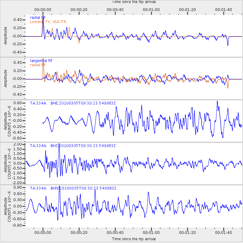
334A Lometa, TX, USA - Earthquake Result Viewer
*The percent match for this event was below the threshold and hence no stack was calculated.
| Earthquake location: |
Near Coast Of Central Chile |
| Earthquake latitude/longitude: |
-36.6/-73.2 |
| Earthquake time(UTC): |
2010/03/05 (064) 09:19:36 GMT |
| Earthquake Depth: |
30 km |
| Earthquake Magnitude: |
5.9 MB, 5.8 MS, 6.1 MW, 6.0 MW |
| Earthquake Catalog/Contributor: |
WHDF/NEIC |
|
| Network: |
TA USArray Transportable Network (new EarthScope stations) |
| Station: |
334A Lometa, TX, USA |
| Lat/Lon: |
31.33 N/98.24 W |
| Elevation: |
389 m |
|
| Distance: |
71.6 deg |
| Az: |
337.578 deg |
| Baz: |
158.988 deg |
| Ray Param: |
$rayparam |
*The percent match for this event was below the threshold and hence was not used in the summary stack. |
|
| Radial Match: |
67.127686 % |
| Radial Bump: |
400 |
| Transverse Match: |
61.093975 % |
| Transverse Bump: |
400 |
| SOD ConfigId: |
299721 |
| Insert Time: |
2010-04-26 16:57:19.467 +0000 |
| GWidth: |
2.5 |
| Max Bumps: |
400 |
| Tol: |
0.001 |
|
Signal To Noise
| Channel | StoN | STA | LTA |
| TA:334A: :BHZ:20100305T09:30:23.549983Z | 3.7676623 | 5.585607E-7 | 1.4825127E-7 |
| TA:334A: :BHN:20100305T09:30:23.549983Z | 1.2329891 | 1.8891875E-7 | 1.5322014E-7 |
| TA:334A: :BHE:20100305T09:30:23.549983Z | 1.6882554 | 1.872509E-7 | 1.10913845E-7 |
| Arrivals |
| Ps | |
| PpPs | |
| PsPs/PpSs | |


