You are here: Home > Network List > PS - Pacific21 Stations List
> Station PSI Parapat, Indonesia > Earthquake Result Viewer
PSI Parapat, Indonesia - Earthquake Result Viewer

| Earthquake location: |
Samoa Islands Region |
| Earthquake latitude/longitude: |
-15.7/-172.5 |
| Earthquake time(UTC): |
2022/12/04 (338) 19:24:27 GMT |
| Earthquake Depth: |
148 km |
| Earthquake Magnitude: |
6.9 Mi |
| Earthquake Catalog/Contributor: |
NEIC PDE/at |
|
| Network: |
PS Pacific21 |
| Station: |
PSI Parapat, Indonesia |
| Lat/Lon: |
2.69 N/98.92 E |
| Elevation: |
987 m |
|
| Distance: |
89.3 deg |
| Az: |
272.96 deg |
| Baz: |
105.65 deg |
| Ray Param: |
0.04173164 |
| Estimated Moho Depth: |
20.5 km |
| Estimated Crust Vp/Vs: |
1.87 |
| Assumed Crust Vp: |
6.468 km/s |
| Estimated Crust Vs: |
3.454 km/s |
| Estimated Crust Poisson's Ratio: |
0.30 |
|
| Radial Match: |
97.72865 % |
| Radial Bump: |
400 |
| Transverse Match: |
95.94365 % |
| Transverse Bump: |
400 |
| SOD ConfigId: |
29823551 |
| Insert Time: |
2022-12-18 20:14:47.989 +0000 |
| GWidth: |
2.5 |
| Max Bumps: |
400 |
| Tol: |
0.001 |
|
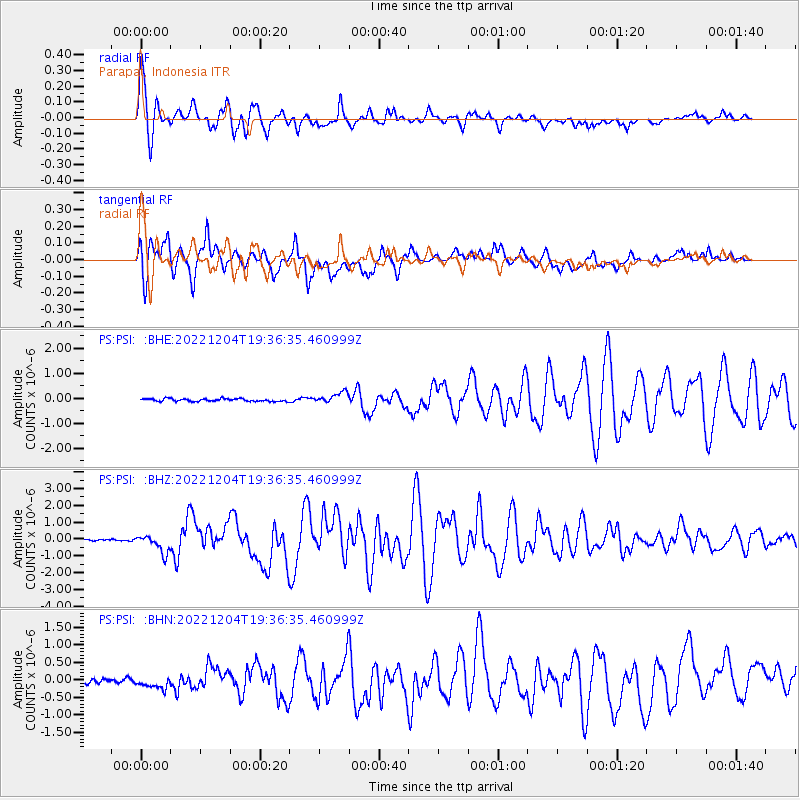
Signal To Noise
| Channel | StoN | STA | LTA |
| PS:PSI: :BHZ:20221204T19:36:35.460999Z | 10.924198 | 5.352173E-7 | 4.899374E-8 |
| PS:PSI: :BHN:20221204T19:36:35.460999Z | 2.2034118 | 2.1272243E-7 | 9.654229E-8 |
| PS:PSI: :BHE:20221204T19:36:35.460999Z | 4.149275 | 2.1739379E-7 | 5.23932E-8 |
| Arrivals |
| Ps | 2.8 SECOND |
| PpPs | 8.9 SECOND |
| PsPs/PpSs | 12 SECOND |


