You are here: Home > Network List > CI - Caltech Regional Seismic Network Stations List
> Station ADO Adelanto Receiving Station, Victorville, CA, USA > Earthquake Result Viewer
ADO Adelanto Receiving Station, Victorville, CA, USA - Earthquake Result Viewer

| Earthquake location: |
Samoa Islands Region |
| Earthquake latitude/longitude: |
-15.4/-173.0 |
| Earthquake time(UTC): |
2022/12/04 (338) 19:24:15 GMT |
| Earthquake Depth: |
36 km |
| Earthquake Magnitude: |
6.7 Mww |
| Earthquake Catalog/Contributor: |
NEIC PDE/us |
|
| Network: |
CI Caltech Regional Seismic Network |
| Station: |
ADO Adelanto Receiving Station, Victorville, CA, USA |
| Lat/Lon: |
34.55 N/117.43 W |
| Elevation: |
908 m |
|
| Distance: |
72.4 deg |
| Az: |
45.54 deg |
| Baz: |
236.52 deg |
| Ray Param: |
0.053608526 |
| Estimated Moho Depth: |
36.0 km |
| Estimated Crust Vp/Vs: |
1.79 |
| Assumed Crust Vp: |
6.276 km/s |
| Estimated Crust Vs: |
3.516 km/s |
| Estimated Crust Poisson's Ratio: |
0.27 |
|
| Radial Match: |
92.93439 % |
| Radial Bump: |
366 |
| Transverse Match: |
89.94131 % |
| Transverse Bump: |
382 |
| SOD ConfigId: |
29823551 |
| Insert Time: |
2022-12-18 20:31:40.132 +0000 |
| GWidth: |
2.5 |
| Max Bumps: |
400 |
| Tol: |
0.001 |
|
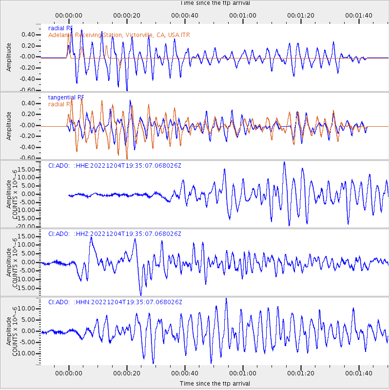
Signal To Noise
| Channel | StoN | STA | LTA |
| CI:ADO: :HHZ:20221204T19:35:07.068026Z | 14.137511 | 4.50163E-6 | 3.1841742E-7 |
| CI:ADO: :HHN:20221204T19:35:07.068026Z | 3.2382627 | 1.3855438E-6 | 4.278664E-7 |
| CI:ADO: :HHE:20221204T19:35:07.068026Z | 3.8354156 | 2.0513396E-6 | 5.3484155E-7 |
| Arrivals |
| Ps | 4.7 SECOND |
| PpPs | 15 SECOND |
| PsPs/PpSs | 20 SECOND |


