You are here: Home > Network List > G - GEOSCOPE Stations List
> Station TAOE Taiohae, Marquises islands > Earthquake Result Viewer
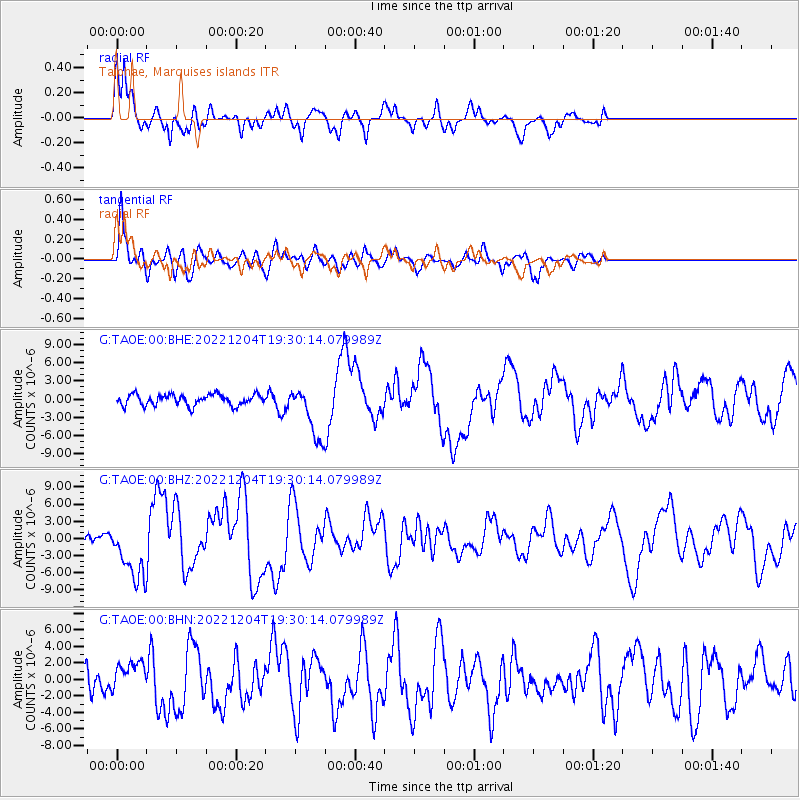
TAOE Taiohae, Marquises islands - Earthquake Result Viewer
*The percent match for this event was below the threshold and hence no stack was calculated.
| Earthquake location: |
Samoa Islands Region |
| Earthquake latitude/longitude: |
-15.4/-173.0 |
| Earthquake time(UTC): |
2022/12/04 (338) 19:24:15 GMT |
| Earthquake Depth: |
36 km |
| Earthquake Magnitude: |
6.7 Mww |
| Earthquake Catalog/Contributor: |
NEIC PDE/us |
|
| Network: |
G GEOSCOPE |
| Station: |
TAOE Taiohae, Marquises islands |
| Lat/Lon: |
8.85 S/140.15 W |
| Elevation: |
800 m |
|
| Distance: |
32.7 deg |
| Az: |
82.382 deg |
| Baz: |
255.335 deg |
| Ray Param: |
$rayparam |
*The percent match for this event was below the threshold and hence was not used in the summary stack. |
|
| Radial Match: |
83.80432 % |
| Radial Bump: |
400 |
| Transverse Match: |
84.86638 % |
| Transverse Bump: |
400 |
| SOD ConfigId: |
29823551 |
| Insert Time: |
2022-12-18 20:36:57.028 +0000 |
| GWidth: |
2.5 |
| Max Bumps: |
400 |
| Tol: |
0.001 |
|
Signal To Noise
| Channel | StoN | STA | LTA |
| G:TAOE:00:BHZ:20221204T19:30:14.079989Z | 4.189028 | 5.011602E-6 | 1.1963641E-6 |
| G:TAOE:00:BHN:20221204T19:30:14.079989Z | 1.2319076 | 1.7915722E-6 | 1.4543074E-6 |
| G:TAOE:00:BHE:20221204T19:30:14.079989Z | 4.721736 | 4.261635E-6 | 9.0255685E-7 |
| Arrivals |
| Ps | |
| PpPs | |
| PsPs/PpSs | |


