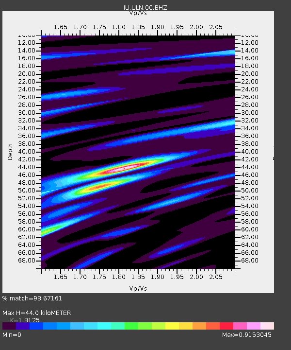
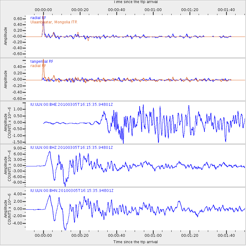
ULN Ulaanbaatar, Mongolia - Earthquake Result Viewer

Earthquake location: Southern Sumatra, Indonesia
Earthquake latitude/longitude: -3.8/101.0
Earthquake time(UTC): 2010/03/05 (064) 16:07:03 GMT
Earthquake Depth: 35 km
Earthquake Magnitude: 6.0 MB, 6.6 MS, 6.8 MW, 6.7 MW
Earthquake Catalog/Contributor: WHDF/NEIC
Network: IU Global Seismograph Network (GSN - IRIS/USGS)
Station: ULN Ulaanbaatar, Mongolia
Lat/Lon: 47.87 N/107.05 E
Elevation: 1610 m
Distance: 51.7 deg
Az: 5.204 deg
Baz: 187.724 deg
Ray Param: 0.067185104
Estimated Moho Depth: 44.0 km
Estimated Crust Vp/Vs: 1.81
Assumed Crust Vp: 6.642 km/s
Estimated Crust Vs: 3.664 km/s
Estimated Crust Poisson's Ratio: 0.28
Radial Match: 98.67161 %
Radial Bump: 271
Transverse Match: 90.1072 %
Transverse Bump: 400
SOD ConfigId: 299721
Insert Time: 2010-04-26 17:20:25.437 +0000
GWidth: 2.5
Max Bumps: 400
Tol: 0.001

Signal To Noise

ChannelStoNSTALTA
IU:ULN:00:BHZ:20100305T16:15:35.94801Z51.6036263.9718584E-67.69686E-8
IU:ULN:00:BHN:20100305T16:15:35.94801Z39.5146451.9893882E-65.034559E-8
IU:ULN:00:BHE:20100305T16:15:35.94801Z11.5375114.0488882E-73.5093258E-8
Arrivals
Ps5.7 SECOND
PpPs18 SECOND
PsPs/PpSs23 SECOND