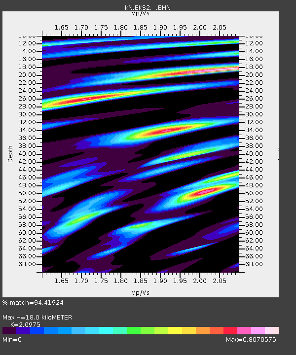
EKS2 KN.EKS2 - Earthquake Result Viewer
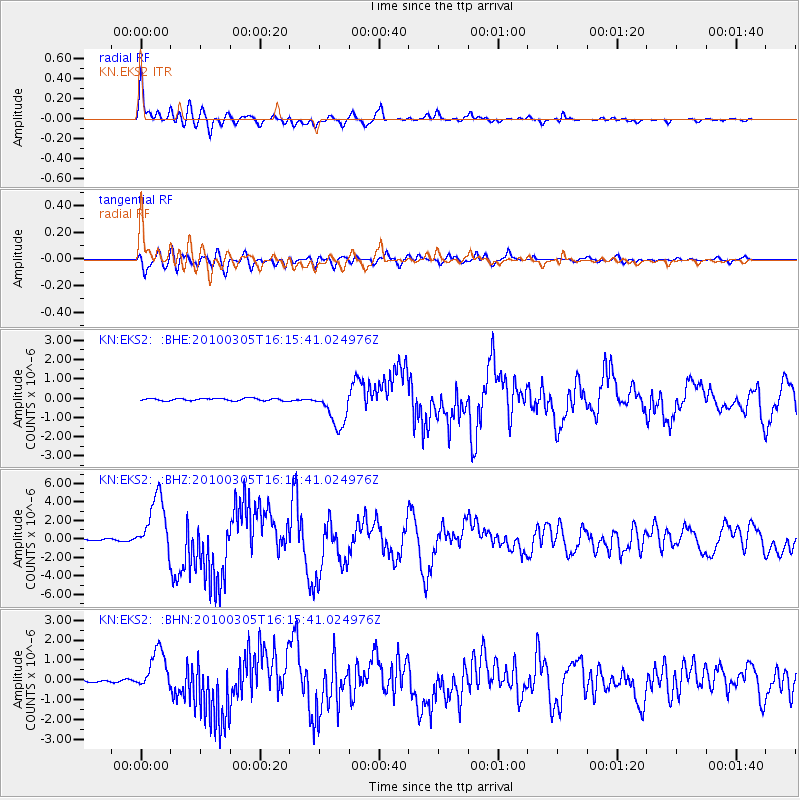
Earthquake location: Southern Sumatra, Indonesia
Earthquake latitude/longitude: -3.8/101.0
Earthquake time(UTC): 2010/03/05 (064) 16:07:03 GMT
Earthquake Depth: 35 km
Earthquake Magnitude: 6.0 MB, 6.6 MS, 6.8 MW, 6.7 MW
Earthquake Catalog/Contributor: WHDF/NEIC
Network: KN Kyrgyz Seismic Telemetry Network
Station: EKS2 KN.EKS2
Lat/Lon: 42.66 N/73.78 E
Elevation: 1360 m
Distance: 52.4 deg
Az: 334.791 deg
Baz: 144.817 deg
Ray Param: 0.06674112
Estimated Moho Depth: 18.0 km
Estimated Crust Vp/Vs: 2.10
Assumed Crust Vp: 6.316 km/s
Estimated Crust Vs: 3.011 km/s
Estimated Crust Poisson's Ratio: 0.35
Radial Match: 94.41924 %
Radial Bump: 400
Transverse Match: 80.792625 %
Transverse Bump: 400
SOD ConfigId: 299721
Insert Time: 2010-04-26 17:21:16.899 +0000
GWidth: 2.5
Max Bumps: 400
Tol: 0.001

Signal To Noise

ChannelStoNSTALTA
KN:EKS2: :BHZ:20100305T16:15:41.024976Z33.4393583.1193874E-69.328491E-8
KN:EKS2: :BHN:20100305T16:15:41.024976Z15.7291991.029729E-66.5466075E-8
KN:EKS2: :BHE:20100305T16:15:41.024976Z15.26065359.67604E-76.3405146E-8
Arrivals
Ps3.3 SECOND
PpPs8.4 SECOND
PsPs/PpSs12 SECOND