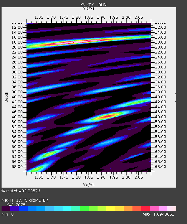
KBK KN.KBK - Earthquake Result Viewer
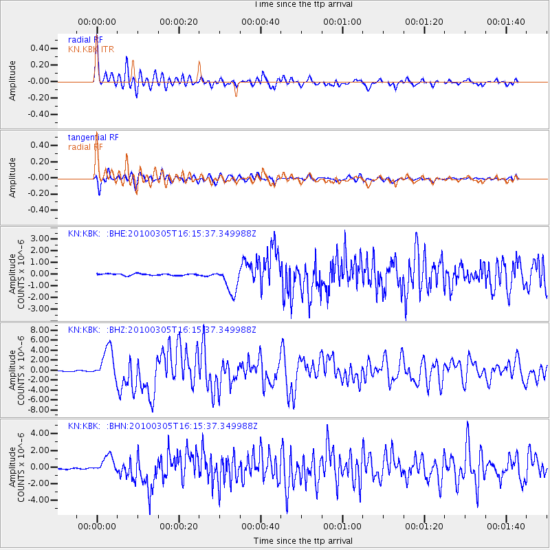
Earthquake location: Southern Sumatra, Indonesia
Earthquake latitude/longitude: -3.8/101.0
Earthquake time(UTC): 2010/03/05 (064) 16:07:03 GMT
Earthquake Depth: 35 km
Earthquake Magnitude: 6.0 MB, 6.6 MS, 6.8 MW, 6.7 MW
Earthquake Catalog/Contributor: WHDF/NEIC
Network: KN Kyrgyz Seismic Telemetry Network
Station: KBK KN.KBK
Lat/Lon: 42.66 N/74.95 E
Elevation: 1760 m
Distance: 51.9 deg
Az: 335.689 deg
Baz: 146.159 deg
Ray Param: 0.06706031
Estimated Moho Depth: 17.75 km
Estimated Crust Vp/Vs: 1.79
Assumed Crust Vp: 6.306 km/s
Estimated Crust Vs: 3.528 km/s
Estimated Crust Poisson's Ratio: 0.27
Radial Match: 93.23576 %
Radial Bump: 400
Transverse Match: 92.698654 %
Transverse Bump: 400
SOD ConfigId: 299721
Insert Time: 2010-04-26 17:21:25.939 +0000
GWidth: 2.5
Max Bumps: 400
Tol: 0.001

Signal To Noise

ChannelStoNSTALTA
KN:KBK: :BHZ:20100305T16:15:37.349988Z39.9716263.2475368E-68.124605E-8
KN:KBK: :BHN:20100305T16:15:37.349988Z13.8447451.0232889E-67.391172E-8
KN:KBK: :BHE:20100305T16:15:37.349988Z16.1496141.1227463E-66.952156E-8
Arrivals
Ps2.3 SECOND
PpPs7.4 SECOND
PsPs/PpSs9.8 SECOND