UCH KN.UCH - Earthquake Result Viewer
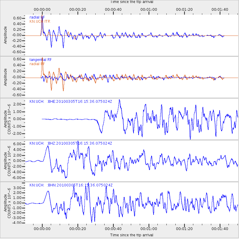
Earthquake location: Southern Sumatra, Indonesia
Earthquake latitude/longitude: -3.8/101.0
Earthquake time(UTC): 2010/03/05 (064) 16:07:03 GMT
Earthquake Depth: 35 km
Earthquake Magnitude: 6.0 MB, 6.6 MS, 6.8 MW, 6.7 MW
Earthquake Catalog/Contributor: WHDF/NEIC
Network: KN Kyrgyz Seismic Telemetry Network
Station: UCH KN.UCH
Lat/Lon: 42.23 N/74.51 E
Elevation: 3850 m
Distance: 51.7 deg
Az: 335.044 deg
Baz: 145.468 deg
Ray Param: 0.06717579
Estimated Moho Depth: 10.0 km
Estimated Crust Vp/Vs: 1.75
Assumed Crust Vp: 6.306 km/s
Estimated Crust Vs: 3.609 km/s
Estimated Crust Poisson's Ratio: 0.26
Radial Match: 95.70145 %
Radial Bump: 400
Transverse Match: 88.6903 %
Transverse Bump: 400
SOD ConfigId: 299721
Insert Time: 2010-04-26 17:21:31.515 +0000
GWidth: 2.5
Max Bumps: 400
Tol: 0.001

Signal To Noise

ChannelStoNSTALTA
KN:UCH: :BHZ:20100305T16:15:36.075024Z23.3483622.9036016E-61.2435997E-7
KN:UCH: :BHN:20100305T16:15:36.075024Z16.3625771.3909545E-68.5008274E-8
KN:UCH: :BHE:20100305T16:15:36.075024Z28.0754039.556222E-73.4037704E-8
Arrivals
Ps1.3 SECOND
PpPs4.1 SECOND
PsPs/PpSs5.4 SECOND