You are here: Home > Network List > CI - Caltech Regional Seismic Network Stations List
> Station LRL Laurel Mtn Radio Fac, Ridgecrest, CA, USA > Earthquake Result Viewer
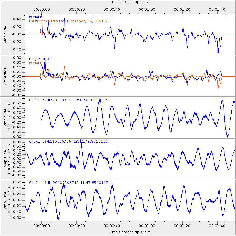
LRL Laurel Mtn Radio Fac, Ridgecrest, CA, USA - Earthquake Result Viewer
*The percent match for this event was below the threshold and hence no stack was calculated.
| Earthquake location: |
Kuril Islands |
| Earthquake latitude/longitude: |
44.2/147.6 |
| Earthquake time(UTC): |
2010/03/06 (065) 13:31:12 GMT |
| Earthquake Depth: |
53 km |
| Earthquake Magnitude: |
5.7 MW, 5.1 MS, 5.4 MB, 5.6 MW |
| Earthquake Catalog/Contributor: |
WHDF/NEIC |
|
| Network: |
CI Caltech Regional Seismic Network |
| Station: |
LRL Laurel Mtn Radio Fac, Ridgecrest, CA, USA |
| Lat/Lon: |
35.48 N/117.68 W |
| Elevation: |
1340 m |
|
| Distance: |
69.3 deg |
| Az: |
60.409 deg |
| Baz: |
309.946 deg |
| Ray Param: |
$rayparam |
*The percent match for this event was below the threshold and hence was not used in the summary stack. |
|
| Radial Match: |
59.83938 % |
| Radial Bump: |
397 |
| Transverse Match: |
72.70789 % |
| Transverse Bump: |
400 |
| SOD ConfigId: |
299721 |
| Insert Time: |
2010-04-26 17:25:25.862 +0000 |
| GWidth: |
2.5 |
| Max Bumps: |
400 |
| Tol: |
0.001 |
|
Signal To Noise
| Channel | StoN | STA | LTA |
| CI:LRL: :BHZ:20100306T13:41:43.851011Z | 0.93591255 | 1.8039303E-7 | 1.927456E-7 |
| CI:LRL: :BHN:20100306T13:41:43.851011Z | 0.80548626 | 2.7287032E-7 | 3.3876472E-7 |
| CI:LRL: :BHE:20100306T13:41:43.851011Z | 2.3402708 | 5.078723E-7 | 2.1701435E-7 |
| Arrivals |
| Ps | |
| PpPs | |
| PsPs/PpSs | |


