You are here: Home > Network List > IC - New China Digital Seismograph Network Stations List
> Station KMI Kunming, Yunnan Province, China > Earthquake Result Viewer
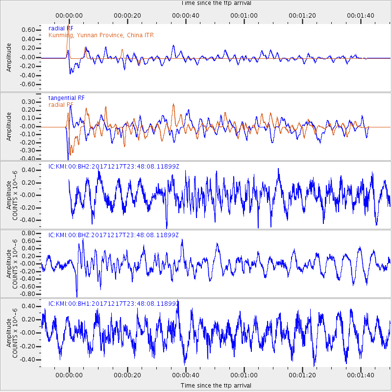
KMI Kunming, Yunnan Province, China - Earthquake Result Viewer
*The percent match for this event was below the threshold and hence no stack was calculated.
| Earthquake location: |
W. Caroline Islands, Micronesia |
| Earthquake latitude/longitude: |
10.0/140.2 |
| Earthquake time(UTC): |
2017/12/17 (351) 23:41:16 GMT |
| Earthquake Depth: |
10 km |
| Earthquake Magnitude: |
5.5 mb |
| Earthquake Catalog/Contributor: |
NEIC PDE/us |
|
| Network: |
IC New China Digital Seismograph Network |
| Station: |
KMI Kunming, Yunnan Province, China |
| Lat/Lon: |
25.12 N/102.74 E |
| Elevation: |
1975 m |
|
| Distance: |
38.5 deg |
| Az: |
297.863 deg |
| Baz: |
106.151 deg |
| Ray Param: |
$rayparam |
*The percent match for this event was below the threshold and hence was not used in the summary stack. |
|
| Radial Match: |
55.58945 % |
| Radial Bump: |
400 |
| Transverse Match: |
43.77241 % |
| Transverse Bump: |
400 |
| SOD ConfigId: |
2973751 |
| Insert Time: |
2018-10-09 04:28:53.612 +0000 |
| GWidth: |
2.5 |
| Max Bumps: |
400 |
| Tol: |
0.001 |
|
Signal To Noise
| Channel | StoN | STA | LTA |
| IC:KMI:00:BHZ:20171217T23:48:08.11899Z | 3.1910284 | 3.158948E-7 | 9.899467E-8 |
| IC:KMI:00:BH1:20171217T23:48:08.11899Z | 1.0599067 | 1.2042143E-7 | 1.1361512E-7 |
| IC:KMI:00:BH2:20171217T23:48:08.11899Z | 0.8991761 | 1.568375E-7 | 1.7442355E-7 |
| Arrivals |
| Ps | |
| PpPs | |
| PsPs/PpSs | |


