You are here: Home > Network List > CI - Caltech Regional Seismic Network Stations List
> Station MPM Manuel Prospect Mine, California, USA > Earthquake Result Viewer
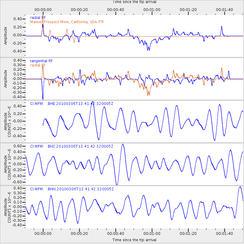
MPM Manuel Prospect Mine, California, USA - Earthquake Result Viewer
*The percent match for this event was below the threshold and hence no stack was calculated.
| Earthquake location: |
Kuril Islands |
| Earthquake latitude/longitude: |
44.2/147.6 |
| Earthquake time(UTC): |
2010/03/06 (065) 13:31:12 GMT |
| Earthquake Depth: |
53 km |
| Earthquake Magnitude: |
5.7 MW, 5.1 MS, 5.4 MB, 5.6 MW |
| Earthquake Catalog/Contributor: |
WHDF/NEIC |
|
| Network: |
CI Caltech Regional Seismic Network |
| Station: |
MPM Manuel Prospect Mine, California, USA |
| Lat/Lon: |
36.06 N/117.49 W |
| Elevation: |
185 m |
|
| Distance: |
69.1 deg |
| Az: |
59.827 deg |
| Baz: |
309.851 deg |
| Ray Param: |
$rayparam |
*The percent match for this event was below the threshold and hence was not used in the summary stack. |
|
| Radial Match: |
42.239197 % |
| Radial Bump: |
400 |
| Transverse Match: |
59.618336 % |
| Transverse Bump: |
335 |
| SOD ConfigId: |
299721 |
| Insert Time: |
2010-04-26 17:25:47.084 +0000 |
| GWidth: |
2.5 |
| Max Bumps: |
400 |
| Tol: |
0.001 |
|
Signal To Noise
| Channel | StoN | STA | LTA |
| CI:MPM: :BHZ:20100306T13:41:42.320005Z | 1.0125462 | 2.1153647E-7 | 2.0891538E-7 |
| CI:MPM: :BHN:20100306T13:41:42.320005Z | 0.8491591 | 1.8910336E-7 | 2.2269485E-7 |
| CI:MPM: :BHE:20100306T13:41:42.320005Z | 1.872099 | 3.2177834E-7 | 1.7188104E-7 |
| Arrivals |
| Ps | |
| PpPs | |
| PsPs/PpSs | |


