You are here: Home > Network List > IU - Global Seismograph Network (GSN - IRIS/USGS) Stations List
> Station FURI Mt. Furi, Ethiopia > Earthquake Result Viewer
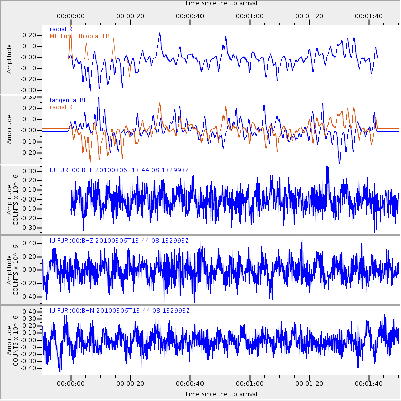
FURI Mt. Furi, Ethiopia - Earthquake Result Viewer
*The percent match for this event was below the threshold and hence no stack was calculated.
| Earthquake location: |
Kuril Islands |
| Earthquake latitude/longitude: |
44.2/147.6 |
| Earthquake time(UTC): |
2010/03/06 (065) 13:31:12 GMT |
| Earthquake Depth: |
53 km |
| Earthquake Magnitude: |
5.7 MW, 5.1 MS, 5.4 MB, 5.6 MW |
| Earthquake Catalog/Contributor: |
WHDF/NEIC |
|
| Network: |
IU Global Seismograph Network (GSN - IRIS/USGS) |
| Station: |
FURI Mt. Furi, Ethiopia |
| Lat/Lon: |
8.90 N/38.68 E |
| Elevation: |
2570 m |
|
| Distance: |
97.1 deg |
| Az: |
289.644 deg |
| Baz: |
43.3 deg |
| Ray Param: |
$rayparam |
*The percent match for this event was below the threshold and hence was not used in the summary stack. |
|
| Radial Match: |
42.24497 % |
| Radial Bump: |
400 |
| Transverse Match: |
36.49869 % |
| Transverse Bump: |
400 |
| SOD ConfigId: |
299721 |
| Insert Time: |
2010-04-26 17:27:10.197 +0000 |
| GWidth: |
2.5 |
| Max Bumps: |
400 |
| Tol: |
0.001 |
|
Signal To Noise
| Channel | StoN | STA | LTA |
| IU:FURI:00:BHZ:20100306T13:44:08.132993Z | 0.82706505 | 1.3079772E-7 | 1.5814682E-7 |
| IU:FURI:00:BHN:20100306T13:44:08.132993Z | 1.0634794 | 1.5313583E-7 | 1.4399511E-7 |
| IU:FURI:00:BHE:20100306T13:44:08.132993Z | 0.9839842 | 1.0387443E-7 | 1.0556514E-7 |
| Arrivals |
| Ps | |
| PpPs | |
| PsPs/PpSs | |


