You are here: Home > Network List > KN - Kyrgyz Seismic Telemetry Network Stations List
> Station ULHL KN.ULHL > Earthquake Result Viewer
ULHL KN.ULHL - Earthquake Result Viewer
*The percent match for this event was below the threshold and hence no stack was calculated.
| Earthquake location: |
Kuril Islands |
| Earthquake latitude/longitude: |
44.2/147.6 |
| Earthquake time(UTC): |
2010/03/06 (065) 13:31:12 GMT |
| Earthquake Depth: |
53 km |
| Earthquake Magnitude: |
5.7 MW, 5.1 MS, 5.4 MB, 5.6 MW |
| Earthquake Catalog/Contributor: |
WHDF/NEIC |
|
| Network: |
KN Kyrgyz Seismic Telemetry Network |
| Station: |
ULHL KN.ULHL |
| Lat/Lon: |
42.25 N/76.24 E |
| Elevation: |
2040 m |
|
| Distance: |
50.5 deg |
| Az: |
294.287 deg |
| Baz: |
62.046 deg |
| Ray Param: |
$rayparam |
*The percent match for this event was below the threshold and hence was not used in the summary stack. |
|
| Radial Match: |
57.192497 % |
| Radial Bump: |
400 |
| Transverse Match: |
57.396225 % |
| Transverse Bump: |
400 |
| SOD ConfigId: |
299721 |
| Insert Time: |
2010-04-26 17:27:43.917 +0000 |
| GWidth: |
2.5 |
| Max Bumps: |
400 |
| Tol: |
0.001 |
|
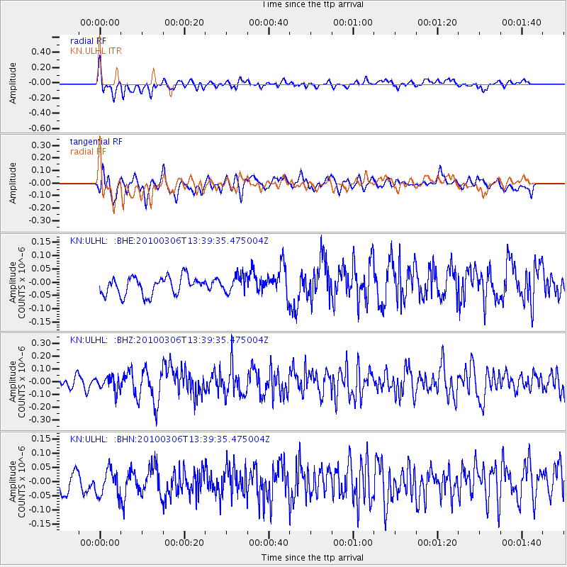
Signal To Noise
| Channel | StoN | STA | LTA |
| KN:ULHL: :BHZ:20100306T13:39:35.475004Z | 1.5056186 | 5.6673002E-8 | 3.764101E-8 |
| KN:ULHL: :BHN:20100306T13:39:35.475004Z | 1.6693391 | 4.9063335E-8 | 2.9390874E-8 |
| KN:ULHL: :BHE:20100306T13:39:35.475004Z | 0.98220193 | 3.308439E-8 | 3.36839E-8 |
| Arrivals |
| Ps | |
| PpPs | |
| PsPs/PpSs | |


