You are here: Home > Network List > TA - USArray Transportable Network (new EarthScope stations) Stations List
> Station Z25A Roswell, NM, USA > Earthquake Result Viewer
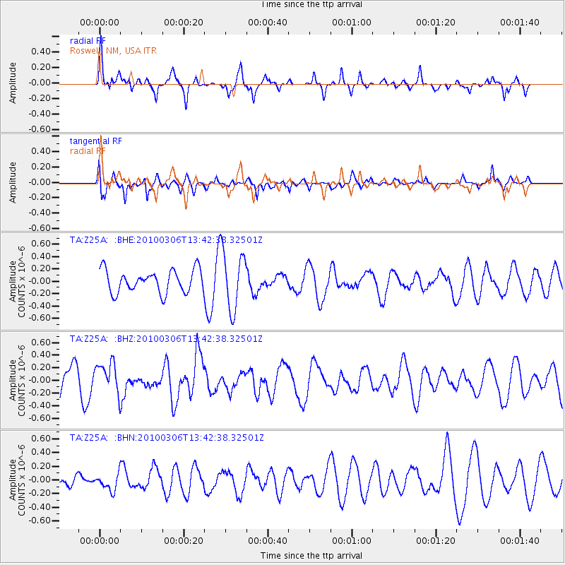
Z25A Roswell, NM, USA - Earthquake Result Viewer
*The percent match for this event was below the threshold and hence no stack was calculated.
| Earthquake location: |
Kuril Islands |
| Earthquake latitude/longitude: |
44.2/147.6 |
| Earthquake time(UTC): |
2010/03/06 (065) 13:31:12 GMT |
| Earthquake Depth: |
53 km |
| Earthquake Magnitude: |
5.7 MW, 5.1 MS, 5.4 MB, 5.6 MW |
| Earthquake Catalog/Contributor: |
WHDF/NEIC |
|
| Network: |
TA USArray Transportable Network (new EarthScope stations) |
| Station: |
Z25A Roswell, NM, USA |
| Lat/Lon: |
33.28 N/104.72 W |
| Elevation: |
1233 m |
|
| Distance: |
78.7 deg |
| Az: |
54.51 deg |
| Baz: |
315.621 deg |
| Ray Param: |
$rayparam |
*The percent match for this event was below the threshold and hence was not used in the summary stack. |
|
| Radial Match: |
50.90801 % |
| Radial Bump: |
302 |
| Transverse Match: |
46.717983 % |
| Transverse Bump: |
389 |
| SOD ConfigId: |
299721 |
| Insert Time: |
2010-04-26 17:30:08.466 +0000 |
| GWidth: |
2.5 |
| Max Bumps: |
400 |
| Tol: |
0.001 |
|
Signal To Noise
| Channel | StoN | STA | LTA |
| TA:Z25A: :BHZ:20100306T13:42:38.32501Z | 1.0746726 | 2.4675023E-7 | 2.2960502E-7 |
| TA:Z25A: :BHN:20100306T13:42:38.32501Z | 0.8146985 | 1.2280277E-7 | 1.5073401E-7 |
| TA:Z25A: :BHE:20100306T13:42:38.32501Z | 2.5299273 | 4.6179082E-7 | 1.8253125E-7 |
| Arrivals |
| Ps | |
| PpPs | |
| PsPs/PpSs | |


