You are here: Home > Network List > IW - Intermountain West Stations List
> Station MOOW Moose Ponds, Wyoming, USA > Earthquake Result Viewer
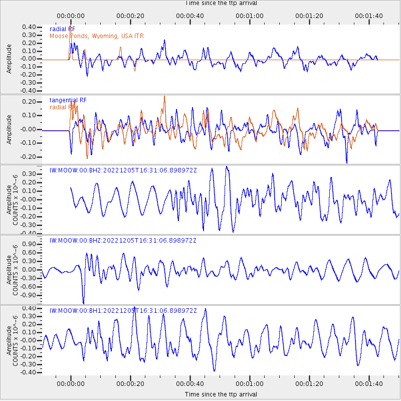
MOOW Moose Ponds, Wyoming, USA - Earthquake Result Viewer
*The percent match for this event was below the threshold and hence no stack was calculated.
| Earthquake location: |
Tonga Islands |
| Earthquake latitude/longitude: |
-15.2/-173.1 |
| Earthquake time(UTC): |
2022/12/05 (339) 16:19:19 GMT |
| Earthquake Depth: |
10 km |
| Earthquake Magnitude: |
5.6 Mww |
| Earthquake Catalog/Contributor: |
NEIC PDE/us |
|
| Network: |
IW Intermountain West |
| Station: |
MOOW Moose Ponds, Wyoming, USA |
| Lat/Lon: |
43.75 N/110.74 W |
| Elevation: |
2128 m |
|
| Distance: |
81.7 deg |
| Az: |
40.459 deg |
| Baz: |
239.814 deg |
| Ray Param: |
$rayparam |
*The percent match for this event was below the threshold and hence was not used in the summary stack. |
|
| Radial Match: |
46.525726 % |
| Radial Bump: |
400 |
| Transverse Match: |
65.7899 % |
| Transverse Bump: |
400 |
| SOD ConfigId: |
29823551 |
| Insert Time: |
2022-12-19 16:36:26.517 +0000 |
| GWidth: |
2.5 |
| Max Bumps: |
400 |
| Tol: |
0.001 |
|
Signal To Noise
| Channel | StoN | STA | LTA |
| IW:MOOW:00:BHZ:20221205T16:31:06.898972Z | 2.1080651 | 3.8683584E-7 | 1.835028E-7 |
| IW:MOOW:00:BH1:20221205T16:31:06.898972Z | 0.7270976 | 1.038942E-7 | 1.4288895E-7 |
| IW:MOOW:00:BH2:20221205T16:31:06.898972Z | 0.7921674 | 9.060549E-8 | 1.1437669E-7 |
| Arrivals |
| Ps | |
| PpPs | |
| PsPs/PpSs | |


