You are here: Home > Network List > US - United States National Seismic Network Stations List
> Station MSO Missoula, Montana, USA > Earthquake Result Viewer
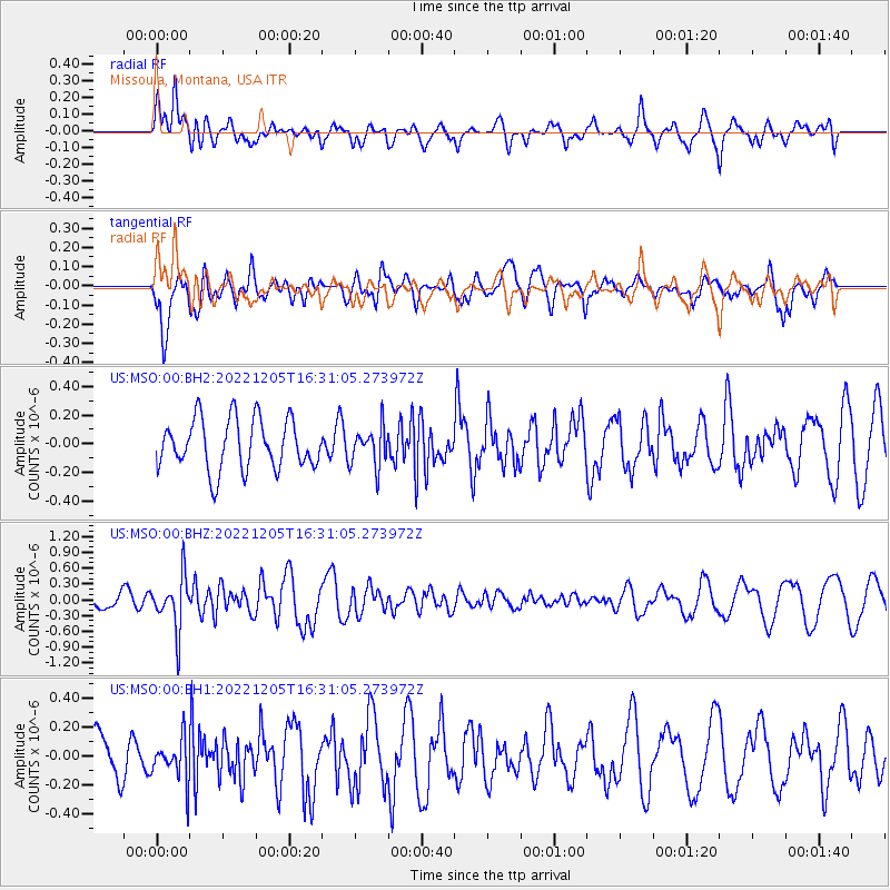
MSO Missoula, Montana, USA - Earthquake Result Viewer
*The percent match for this event was below the threshold and hence no stack was calculated.
| Earthquake location: |
Tonga Islands |
| Earthquake latitude/longitude: |
-15.2/-173.1 |
| Earthquake time(UTC): |
2022/12/05 (339) 16:19:19 GMT |
| Earthquake Depth: |
10 km |
| Earthquake Magnitude: |
5.6 Mww |
| Earthquake Catalog/Contributor: |
NEIC PDE/us |
|
| Network: |
US United States National Seismic Network |
| Station: |
MSO Missoula, Montana, USA |
| Lat/Lon: |
46.83 N/113.94 W |
| Elevation: |
1264 m |
|
| Distance: |
81.4 deg |
| Az: |
36.612 deg |
| Baz: |
236.982 deg |
| Ray Param: |
$rayparam |
*The percent match for this event was below the threshold and hence was not used in the summary stack. |
|
| Radial Match: |
56.477493 % |
| Radial Bump: |
400 |
| Transverse Match: |
60.22039 % |
| Transverse Bump: |
400 |
| SOD ConfigId: |
29823551 |
| Insert Time: |
2022-12-19 16:47:51.441 +0000 |
| GWidth: |
2.5 |
| Max Bumps: |
400 |
| Tol: |
0.001 |
|
Signal To Noise
| Channel | StoN | STA | LTA |
| US:MSO:00:BHZ:20221205T16:31:05.273972Z | 2.412883 | 5.005208E-7 | 2.0743684E-7 |
| US:MSO:00:BH1:20221205T16:31:05.273972Z | 0.8651328 | 1.4584126E-7 | 1.6857672E-7 |
| US:MSO:00:BH2:20221205T16:31:05.273972Z | 0.7728772 | 1.3582036E-7 | 1.7573342E-7 |
| Arrivals |
| Ps | |
| PpPs | |
| PsPs/PpSs | |


