You are here: Home > Network List > TA - USArray Transportable Network (new EarthScope stations) Stations List
> Station E30A Jud, ND, USA > Earthquake Result Viewer
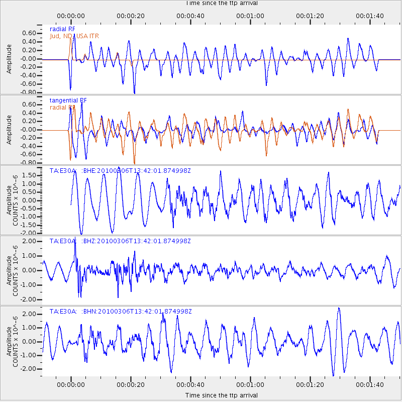
E30A Jud, ND, USA - Earthquake Result Viewer
*The percent match for this event was below the threshold and hence no stack was calculated.
| Earthquake location: |
Kuril Islands |
| Earthquake latitude/longitude: |
44.2/147.6 |
| Earthquake time(UTC): |
2010/03/06 (065) 13:31:12 GMT |
| Earthquake Depth: |
53 km |
| Earthquake Magnitude: |
5.7 MW, 5.1 MS, 5.4 MB, 5.6 MW |
| Earthquake Catalog/Contributor: |
WHDF/NEIC |
|
| Network: |
TA USArray Transportable Network (new EarthScope stations) |
| Station: |
E30A Jud, ND, USA |
| Lat/Lon: |
46.50 N/98.91 W |
| Elevation: |
544 m |
|
| Distance: |
72.3 deg |
| Az: |
41.706 deg |
| Baz: |
316.128 deg |
| Ray Param: |
$rayparam |
*The percent match for this event was below the threshold and hence was not used in the summary stack. |
|
| Radial Match: |
55.644993 % |
| Radial Bump: |
400 |
| Transverse Match: |
67.65674 % |
| Transverse Bump: |
400 |
| SOD ConfigId: |
299721 |
| Insert Time: |
2010-04-26 17:39:51.383 +0000 |
| GWidth: |
2.5 |
| Max Bumps: |
400 |
| Tol: |
0.001 |
|
Signal To Noise
| Channel | StoN | STA | LTA |
| TA:E30A: :BHZ:20100306T13:42:01.874998Z | 1.9167478 | 8.3920884E-7 | 4.3782953E-7 |
| TA:E30A: :BHN:20100306T13:42:01.874998Z | 0.6406196 | 5.2305415E-7 | 8.1648164E-7 |
| TA:E30A: :BHE:20100306T13:42:01.874998Z | 0.6213184 | 7.1902286E-7 | 1.1572536E-6 |
| Arrivals |
| Ps | |
| PpPs | |
| PsPs/PpSs | |


