You are here: Home > Network List > US - United States National Seismic Network Stations List
> Station DGMT Dagmar, Montana, USA > Earthquake Result Viewer
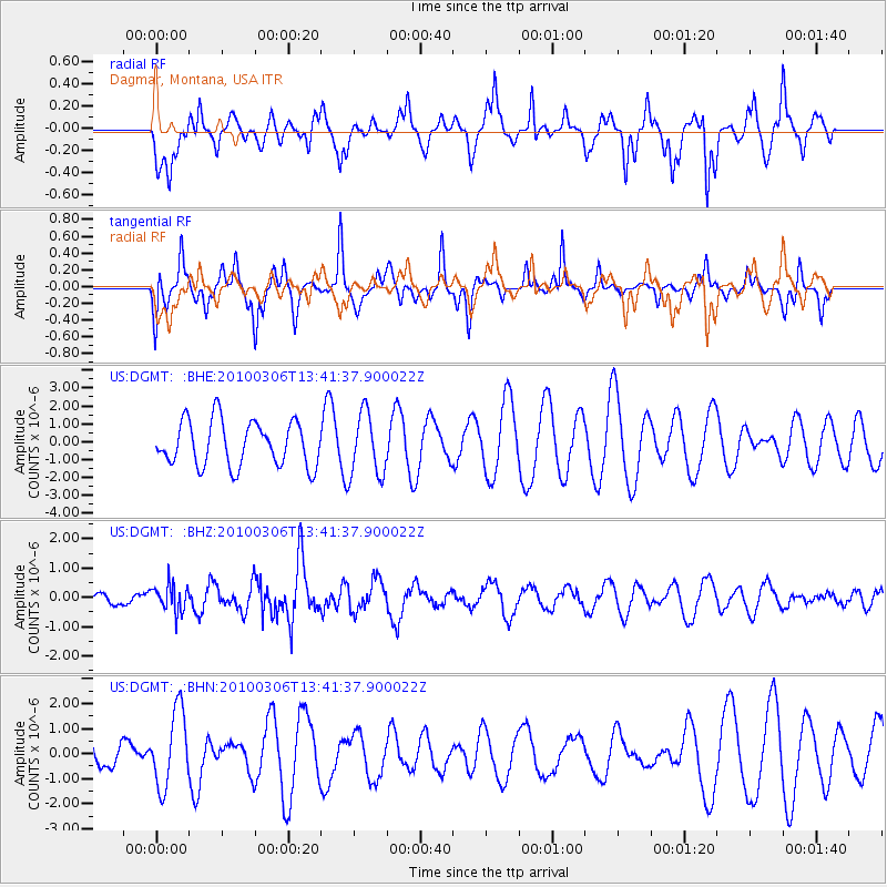
DGMT Dagmar, Montana, USA - Earthquake Result Viewer
*The percent match for this event was below the threshold and hence no stack was calculated.
| Earthquake location: |
Kuril Islands |
| Earthquake latitude/longitude: |
44.2/147.6 |
| Earthquake time(UTC): |
2010/03/06 (065) 13:31:12 GMT |
| Earthquake Depth: |
53 km |
| Earthquake Magnitude: |
5.7 MW, 5.1 MS, 5.4 MB, 5.6 MW |
| Earthquake Catalog/Contributor: |
WHDF/NEIC |
|
| Network: |
US United States National Seismic Network |
| Station: |
DGMT Dagmar, Montana, USA |
| Lat/Lon: |
48.47 N/104.20 W |
| Elevation: |
0.0 m |
|
| Distance: |
68.3 deg |
| Az: |
42.875 deg |
| Baz: |
312.636 deg |
| Ray Param: |
$rayparam |
*The percent match for this event was below the threshold and hence was not used in the summary stack. |
|
| Radial Match: |
44.59803 % |
| Radial Bump: |
307 |
| Transverse Match: |
41.770157 % |
| Transverse Bump: |
243 |
| SOD ConfigId: |
299721 |
| Insert Time: |
2010-04-26 17:44:10.929 +0000 |
| GWidth: |
2.5 |
| Max Bumps: |
400 |
| Tol: |
0.001 |
|
Signal To Noise
| Channel | StoN | STA | LTA |
| US:DGMT: :BHZ:20100306T13:41:37.900022Z | 1.4695535 | 4.493556E-7 | 3.0577698E-7 |
| US:DGMT: :BHN:20100306T13:41:37.900022Z | 2.9344473 | 1.5067625E-6 | 5.13474E-7 |
| US:DGMT: :BHE:20100306T13:41:37.900022Z | 1.4085993 | 1.759321E-6 | 1.2489862E-6 |
| Arrivals |
| Ps | |
| PpPs | |
| PsPs/PpSs | |


