You are here: Home > Network List > AZ - ANZA Regional Network Stations List
> Station SMER AZ.SMER > Earthquake Result Viewer
SMER AZ.SMER - Earthquake Result Viewer
*The percent match for this event was below the threshold and hence no stack was calculated.
| Earthquake location: |
Southern East Pacific Rise |
| Earthquake latitude/longitude: |
-16.2/-115.3 |
| Earthquake time(UTC): |
2010/03/07 (066) 07:05:23 GMT |
| Earthquake Depth: |
10 km |
| Earthquake Magnitude: |
5.8 MB, 5.7 MS, 6.3 MW, 6.2 MW |
| Earthquake Catalog/Contributor: |
WHDF/NEIC |
|
| Network: |
AZ ANZA Regional Network |
| Station: |
SMER AZ.SMER |
| Lat/Lon: |
33.46 N/117.17 W |
| Elevation: |
355 m |
|
| Distance: |
49.5 deg |
| Az: |
357.938 deg |
| Baz: |
177.631 deg |
| Ray Param: |
$rayparam |
*The percent match for this event was below the threshold and hence was not used in the summary stack. |
|
| Radial Match: |
60.1918 % |
| Radial Bump: |
400 |
| Transverse Match: |
68.76414 % |
| Transverse Bump: |
400 |
| SOD ConfigId: |
299721 |
| Insert Time: |
2010-04-26 17:46:28.131 +0000 |
| GWidth: |
2.5 |
| Max Bumps: |
400 |
| Tol: |
0.001 |
|
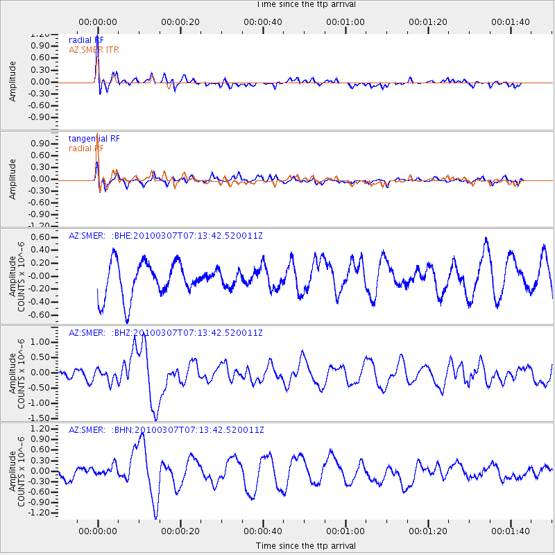
Signal To Noise
| Channel | StoN | STA | LTA |
| AZ:SMER: :BHZ:20100307T07:13:42.520011Z | 0.863094 | 1.8604213E-7 | 2.1555257E-7 |
| AZ:SMER: :BHN:20100307T07:13:42.520011Z | 0.89726806 | 2.544834E-7 | 2.8362027E-7 |
| AZ:SMER: :BHE:20100307T07:13:42.520011Z | 0.44872496 | 1.2269247E-7 | 2.7342466E-7 |
| Arrivals |
| Ps | |
| PpPs | |
| PsPs/PpSs | |


