You are here: Home > Network List > G - GEOSCOPE Stations List
> Station MPG Montagne des Peres, French Guyana > Earthquake Result Viewer
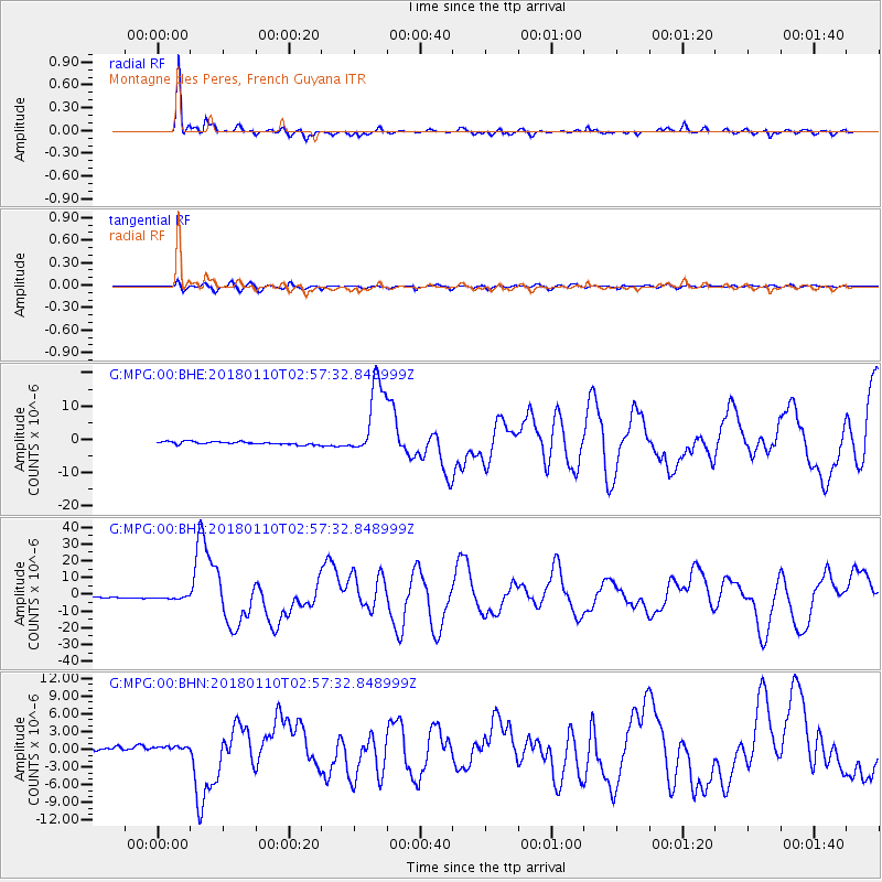
MPG Montagne des Peres, French Guyana - Earthquake Result Viewer
*The percent match for this event was below the threshold and hence no stack was calculated.
| Earthquake location: |
North Of Honduras |
| Earthquake latitude/longitude: |
17.5/-83.6 |
| Earthquake time(UTC): |
2018/01/10 (010) 02:51:31 GMT |
| Earthquake Depth: |
33 km |
| Earthquake Magnitude: |
7.8 Mi |
| Earthquake Catalog/Contributor: |
NEIC PDE/pt |
|
| Network: |
G GEOSCOPE |
| Station: |
MPG Montagne des Peres, French Guyana |
| Lat/Lon: |
5.11 N/52.64 W |
| Elevation: |
147 m |
|
| Distance: |
32.7 deg |
| Az: |
108.48 deg |
| Baz: |
294.684 deg |
| Ray Param: |
$rayparam |
*The percent match for this event was below the threshold and hence was not used in the summary stack. |
|
| Radial Match: |
92.68184 % |
| Radial Bump: |
355 |
| Transverse Match: |
80.71579 % |
| Transverse Bump: |
400 |
| SOD ConfigId: |
2973751 |
| Insert Time: |
2018-10-09 05:28:51.860 +0000 |
| GWidth: |
2.5 |
| Max Bumps: |
400 |
| Tol: |
0.001 |
|
Signal To Noise
| Channel | StoN | STA | LTA |
| G:MPG:00:BHZ:20180110T02:57:32.848999Z | 1.9773606 | 9.918034E-7 | 5.015794E-7 |
| G:MPG:00:BHN:20180110T02:57:32.848999Z | 1.2881358 | 4.04206E-7 | 3.1379147E-7 |
| G:MPG:00:BHE:20180110T02:57:32.848999Z | 2.4930034 | 9.438803E-7 | 3.7861173E-7 |
| Arrivals |
| Ps | |
| PpPs | |
| PsPs/PpSs | |


