You are here: Home > Network List > G - GEOSCOPE Stations List
> Station TAOE Taiohae, Marquises islands > Earthquake Result Viewer
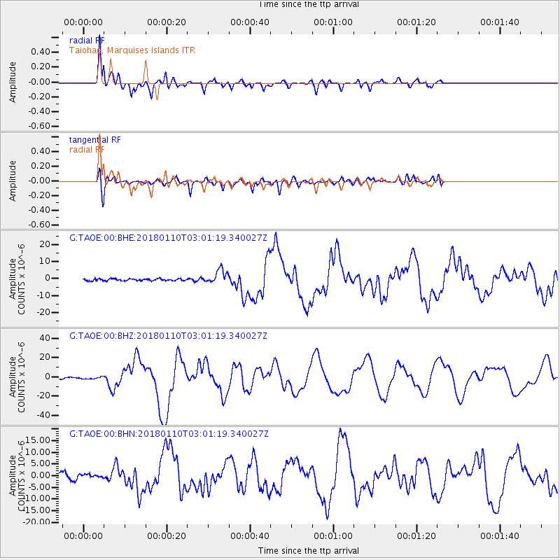
TAOE Taiohae, Marquises islands - Earthquake Result Viewer
*The percent match for this event was below the threshold and hence no stack was calculated.
| Earthquake location: |
North Of Honduras |
| Earthquake latitude/longitude: |
17.5/-83.6 |
| Earthquake time(UTC): |
2018/01/10 (010) 02:51:31 GMT |
| Earthquake Depth: |
33 km |
| Earthquake Magnitude: |
7.8 Mi |
| Earthquake Catalog/Contributor: |
NEIC PDE/pt |
|
| Network: |
G GEOSCOPE |
| Station: |
TAOE Taiohae, Marquises islands |
| Lat/Lon: |
8.85 S/140.15 W |
| Elevation: |
800 m |
|
| Distance: |
61.7 deg |
| Az: |
249.489 deg |
| Baz: |
64.744 deg |
| Ray Param: |
$rayparam |
*The percent match for this event was below the threshold and hence was not used in the summary stack. |
|
| Radial Match: |
94.53508 % |
| Radial Bump: |
395 |
| Transverse Match: |
76.799866 % |
| Transverse Bump: |
400 |
| SOD ConfigId: |
2973751 |
| Insert Time: |
2018-10-09 05:28:56.302 +0000 |
| GWidth: |
2.5 |
| Max Bumps: |
400 |
| Tol: |
0.001 |
|
Signal To Noise
| Channel | StoN | STA | LTA |
| G:TAOE:00:BHZ:20180110T03:01:19.340027Z | 0.7233094 | 9.351478E-7 | 1.2928738E-6 |
| G:TAOE:00:BHN:20180110T03:01:19.340027Z | 0.63420576 | 7.714456E-7 | 1.2163964E-6 |
| G:TAOE:00:BHE:20180110T03:01:19.340027Z | 1.4338217 | 7.91461E-7 | 5.51994E-7 |
| Arrivals |
| Ps | |
| PpPs | |
| PsPs/PpSs | |


