NNA Nana, Peru - Earthquake Result Viewer
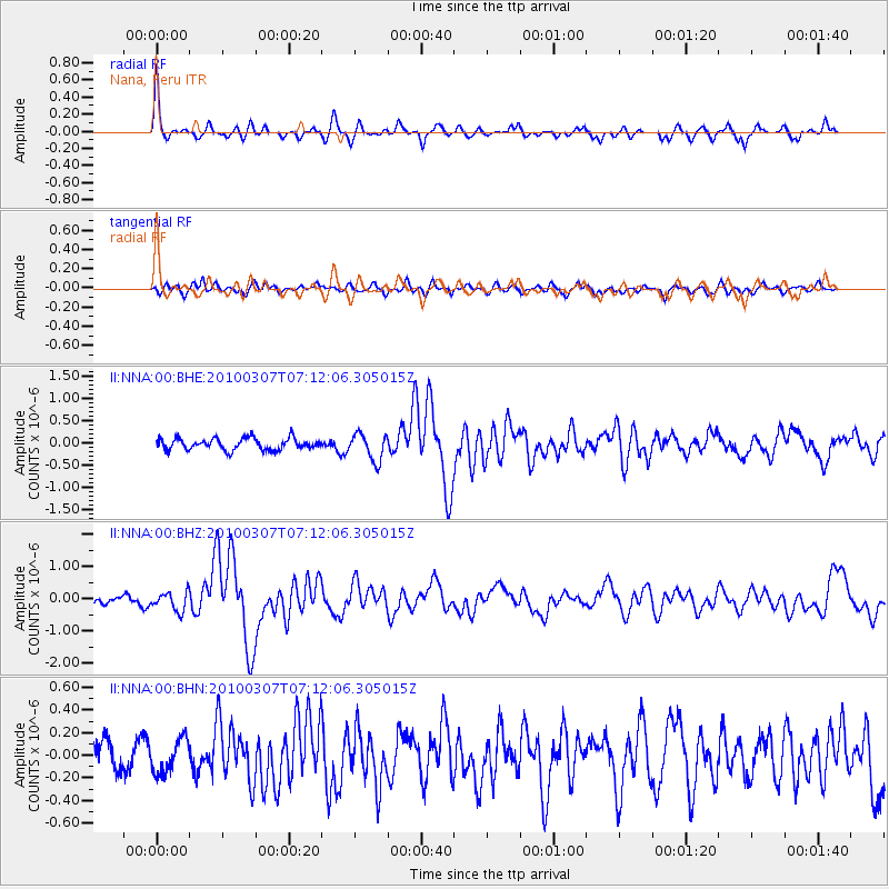
Earthquake location: Southern East Pacific Rise
Earthquake latitude/longitude: -16.2/-115.3
Earthquake time(UTC): 2010/03/07 (066) 07:05:23 GMT
Earthquake Depth: 10 km
Earthquake Magnitude: 5.8 MB, 5.7 MS, 6.3 MW, 6.2 MW
Earthquake Catalog/Contributor: WHDF/NEIC
Network: II Global Seismograph Network (GSN - IRIS/IDA)
Station: NNA Nana, Peru
Lat/Lon: 11.99 S/76.84 W
Elevation: 575 m
Distance: 37.5 deg
Az: 88.61 deg
Baz: 258.94 deg
Ray Param: 0.07610493
Estimated Moho Depth: 69.75 km
Estimated Crust Vp/Vs: 1.71
Assumed Crust Vp: 6.472 km/s
Estimated Crust Vs: 3.779 km/s
Estimated Crust Poisson's Ratio: 0.24
Radial Match: 82.32839 %
Radial Bump: 305
Transverse Match: 58.74303 %
Transverse Bump: 400
SOD ConfigId: 299721
Insert Time: 2010-04-26 17:48:14.359 +0000
GWidth: 2.5
Max Bumps: 400
Tol: 0.001

Signal To Noise

ChannelStoNSTALTA
II:NNA:00:BHZ:20100307T07:12:06.305015Z1.88832622.8918964E-71.5314602E-7
II:NNA:00:BHN:20100307T07:12:06.305015Z1.11424051.477451E-71.3259714E-7
II:NNA:00:BHE:20100307T07:12:06.305015Z2.32536773.000452E-71.2903129E-7
Arrivals
Ps8.3 SECOND
PpPs27 SECOND
PsPs/PpSs35 SECOND