You are here: Home > Network List > IW - Intermountain West Stations List
> Station MOOW Moose Ponds, Wyoming, USA > Earthquake Result Viewer
MOOW Moose Ponds, Wyoming, USA - Earthquake Result Viewer
*The percent match for this event was below the threshold and hence no stack was calculated.
| Earthquake location: |
North Of Honduras |
| Earthquake latitude/longitude: |
17.5/-83.6 |
| Earthquake time(UTC): |
2018/01/10 (010) 02:51:31 GMT |
| Earthquake Depth: |
33 km |
| Earthquake Magnitude: |
7.8 Mi |
| Earthquake Catalog/Contributor: |
NEIC PDE/pt |
|
| Network: |
IW Intermountain West |
| Station: |
MOOW Moose Ponds, Wyoming, USA |
| Lat/Lon: |
43.75 N/110.74 W |
| Elevation: |
2128 m |
|
| Distance: |
34.8 deg |
| Az: |
324.539 deg |
| Baz: |
130.188 deg |
| Ray Param: |
$rayparam |
*The percent match for this event was below the threshold and hence was not used in the summary stack. |
|
| Radial Match: |
94.39926 % |
| Radial Bump: |
355 |
| Transverse Match: |
72.558426 % |
| Transverse Bump: |
400 |
| SOD ConfigId: |
2973751 |
| Insert Time: |
2018-10-09 05:29:49.450 +0000 |
| GWidth: |
2.5 |
| Max Bumps: |
400 |
| Tol: |
0.001 |
|
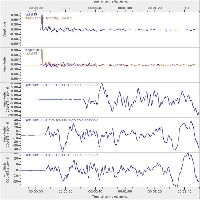
Signal To Noise
| Channel | StoN | STA | LTA |
| IW:MOOW:00:BHZ:20180110T02:57:52.223999Z | 0.9452913 | 1.6472245E-7 | 1.7425576E-7 |
| IW:MOOW:00:BH1:20180110T02:57:52.223999Z | 0.3772528 | 1.2062347E-7 | 3.1974173E-7 |
| IW:MOOW:00:BH2:20180110T02:57:52.223999Z | 1.2834312 | 2.1938612E-7 | 1.709372E-7 |
| Arrivals |
| Ps | |
| PpPs | |
| PsPs/PpSs | |


