You are here: Home > Network List > IW - Intermountain West Stations List
> Station PLID Pearl Lake, Idaho, USA > Earthquake Result Viewer
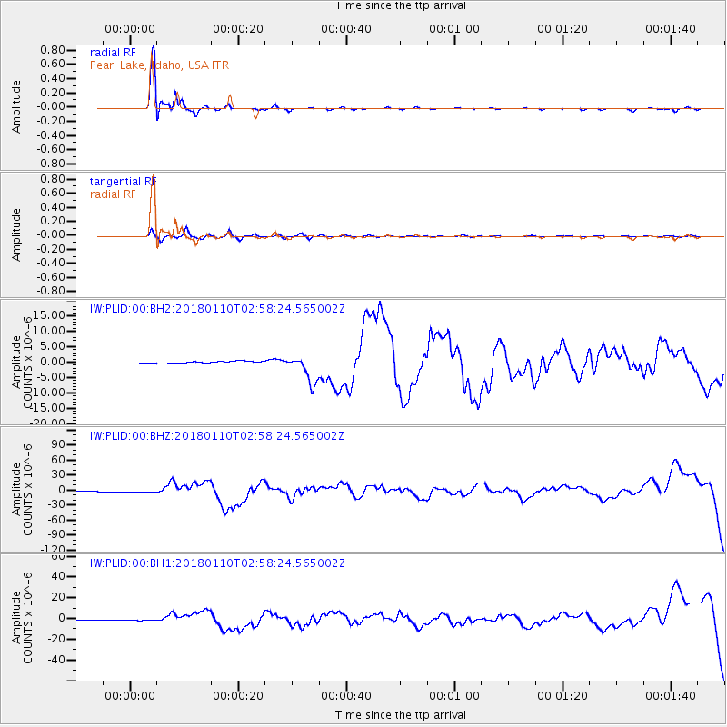
PLID Pearl Lake, Idaho, USA - Earthquake Result Viewer
*The percent match for this event was below the threshold and hence no stack was calculated.
| Earthquake location: |
North Of Honduras |
| Earthquake latitude/longitude: |
17.5/-83.6 |
| Earthquake time(UTC): |
2018/01/10 (010) 02:51:31 GMT |
| Earthquake Depth: |
33 km |
| Earthquake Magnitude: |
7.8 Mi |
| Earthquake Catalog/Contributor: |
NEIC PDE/pt |
|
| Network: |
IW Intermountain West |
| Station: |
PLID Pearl Lake, Idaho, USA |
| Lat/Lon: |
45.09 N/116.00 W |
| Elevation: |
2164 m |
|
| Distance: |
38.6 deg |
| Az: |
322.476 deg |
| Baz: |
124.866 deg |
| Ray Param: |
$rayparam |
*The percent match for this event was below the threshold and hence was not used in the summary stack. |
|
| Radial Match: |
97.570694 % |
| Radial Bump: |
254 |
| Transverse Match: |
77.124565 % |
| Transverse Bump: |
400 |
| SOD ConfigId: |
2973751 |
| Insert Time: |
2018-10-09 05:29:52.210 +0000 |
| GWidth: |
2.5 |
| Max Bumps: |
400 |
| Tol: |
0.001 |
|
Signal To Noise
| Channel | StoN | STA | LTA |
| IW:PLID:00:BHZ:20180110T02:58:24.565002Z | 1.9178997 | 1.0640525E-6 | 5.548009E-7 |
| IW:PLID:00:BH1:20180110T02:58:24.565002Z | 2.34931 | 6.145277E-7 | 2.6157795E-7 |
| IW:PLID:00:BH2:20180110T02:58:24.565002Z | 2.474459 | 7.579198E-7 | 3.0629718E-7 |
| Arrivals |
| Ps | |
| PpPs | |
| PsPs/PpSs | |


