You are here: Home > Network List > TA - USArray Transportable Network (new EarthScope stations) Stations List
> Station H20A Greybull, WY, USA > Earthquake Result Viewer
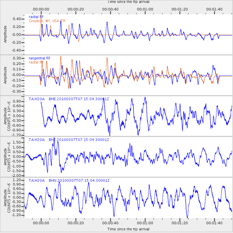
H20A Greybull, WY, USA - Earthquake Result Viewer
*The percent match for this event was below the threshold and hence no stack was calculated.
| Earthquake location: |
Southern East Pacific Rise |
| Earthquake latitude/longitude: |
-16.2/-115.3 |
| Earthquake time(UTC): |
2010/03/07 (066) 07:05:23 GMT |
| Earthquake Depth: |
10 km |
| Earthquake Magnitude: |
5.8 MB, 5.7 MS, 6.3 MW, 6.2 MW |
| Earthquake Catalog/Contributor: |
WHDF/NEIC |
|
| Network: |
TA USArray Transportable Network (new EarthScope stations) |
| Station: |
H20A Greybull, WY, USA |
| Lat/Lon: |
44.49 N/108.00 W |
| Elevation: |
1236 m |
|
| Distance: |
60.8 deg |
| Az: |
5.979 deg |
| Baz: |
188.035 deg |
| Ray Param: |
$rayparam |
*The percent match for this event was below the threshold and hence was not used in the summary stack. |
|
| Radial Match: |
66.35971 % |
| Radial Bump: |
400 |
| Transverse Match: |
62.26654 % |
| Transverse Bump: |
400 |
| SOD ConfigId: |
299721 |
| Insert Time: |
2010-04-26 17:54:48.844 +0000 |
| GWidth: |
2.5 |
| Max Bumps: |
400 |
| Tol: |
0.001 |
|
Signal To Noise
| Channel | StoN | STA | LTA |
| TA:H20A: :BHZ:20100307T07:15:04.30001Z | 3.6563463 | 5.795991E-7 | 1.5851865E-7 |
| TA:H20A: :BHN:20100307T07:15:04.30001Z | 1.1024903 | 3.8398483E-7 | 3.4828864E-7 |
| TA:H20A: :BHE:20100307T07:15:04.30001Z | 0.78589195 | 2.5091737E-7 | 3.192772E-7 |
| Arrivals |
| Ps | |
| PpPs | |
| PsPs/PpSs | |


