You are here: Home > Network List > NE - New England Seismic Network Stations List
> Station PQI Presque Isle, ME, USA > Earthquake Result Viewer
PQI Presque Isle, ME, USA - Earthquake Result Viewer
*The percent match for this event was below the threshold and hence no stack was calculated.
| Earthquake location: |
North Of Honduras |
| Earthquake latitude/longitude: |
17.5/-83.6 |
| Earthquake time(UTC): |
2018/01/10 (010) 02:51:31 GMT |
| Earthquake Depth: |
33 km |
| Earthquake Magnitude: |
7.8 Mi |
| Earthquake Catalog/Contributor: |
NEIC PDE/pt |
|
| Network: |
NE New England Seismic Network |
| Station: |
PQI Presque Isle, ME, USA |
| Lat/Lon: |
46.67 N/68.02 W |
| Elevation: |
162 m |
|
| Distance: |
31.8 deg |
| Az: |
20.492 deg |
| Baz: |
209.022 deg |
| Ray Param: |
$rayparam |
*The percent match for this event was below the threshold and hence was not used in the summary stack. |
|
| Radial Match: |
91.11385 % |
| Radial Bump: |
317 |
| Transverse Match: |
79.31141 % |
| Transverse Bump: |
400 |
| SOD ConfigId: |
2973751 |
| Insert Time: |
2018-10-09 05:30:02.668 +0000 |
| GWidth: |
2.5 |
| Max Bumps: |
400 |
| Tol: |
0.001 |
|
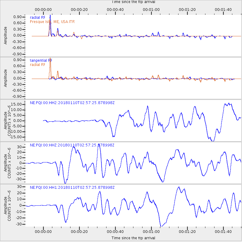
Signal To Noise
| Channel | StoN | STA | LTA |
| NE:PQI:00:HHZ:20180110T02:57:25.878998Z | 1.9715413 | 1.605082E-6 | 8.141255E-7 |
| NE:PQI:00:HH1:20180110T02:57:25.878998Z | 1.9539024 | 1.1440255E-6 | 5.85508E-7 |
| NE:PQI:00:HH2:20180110T02:57:25.878998Z | 1.9247061 | 6.7839613E-7 | 3.5246737E-7 |
| Arrivals |
| Ps | |
| PpPs | |
| PsPs/PpSs | |


