You are here: Home > Network List > US - United States National Seismic Network Stations List
> Station MNTX Cornudas Mountains, Texas, USA > Earthquake Result Viewer
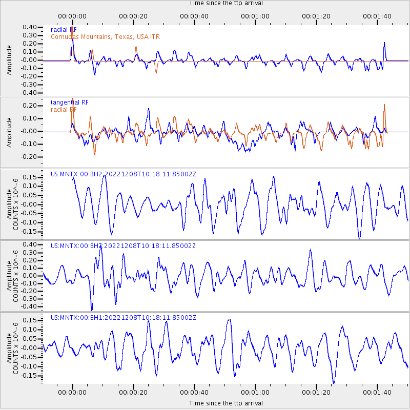
MNTX Cornudas Mountains, Texas, USA - Earthquake Result Viewer
*The percent match for this event was below the threshold and hence no stack was calculated.
| Earthquake location: |
Tonga Islands |
| Earthquake latitude/longitude: |
-15.1/-173.1 |
| Earthquake time(UTC): |
2022/12/08 (342) 10:06:36 GMT |
| Earthquake Depth: |
17 km |
| Earthquake Magnitude: |
5.6 Mww |
| Earthquake Catalog/Contributor: |
NEIC PDE/us |
|
| Network: |
US United States National Seismic Network |
| Station: |
MNTX Cornudas Mountains, Texas, USA |
| Lat/Lon: |
31.70 N/105.38 W |
| Elevation: |
405 m |
|
| Distance: |
79.8 deg |
| Az: |
53.25 deg |
| Baz: |
245.228 deg |
| Ray Param: |
$rayparam |
*The percent match for this event was below the threshold and hence was not used in the summary stack. |
|
| Radial Match: |
63.162777 % |
| Radial Bump: |
400 |
| Transverse Match: |
43.68844 % |
| Transverse Bump: |
400 |
| SOD ConfigId: |
29823551 |
| Insert Time: |
2022-12-22 10:29:40.177 +0000 |
| GWidth: |
2.5 |
| Max Bumps: |
400 |
| Tol: |
0.001 |
|
Signal To Noise
| Channel | StoN | STA | LTA |
| US:MNTX:00:BHZ:20221208T10:18:11.85002Z | 0.6928271 | 5.524305E-8 | 7.973569E-8 |
| US:MNTX:00:BH1:20221208T10:18:11.85002Z | 0.53826195 | 3.2014054E-8 | 5.9476715E-8 |
| US:MNTX:00:BH2:20221208T10:18:11.85002Z | 0.30969608 | 2.2870827E-8 | 7.3849264E-8 |
| Arrivals |
| Ps | |
| PpPs | |
| PsPs/PpSs | |


