You are here: Home > Network List > TA - USArray Transportable Network (new EarthScope stations) Stations List
> Station I22A 9 Mile Ranch, Kaycee, WY, USA > Earthquake Result Viewer
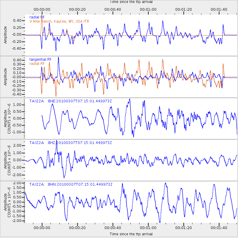
I22A 9 Mile Ranch, Kaycee, WY, USA - Earthquake Result Viewer
*The percent match for this event was below the threshold and hence no stack was calculated.
| Earthquake location: |
Southern East Pacific Rise |
| Earthquake latitude/longitude: |
-16.2/-115.3 |
| Earthquake time(UTC): |
2010/03/07 (066) 07:05:23 GMT |
| Earthquake Depth: |
10 km |
| Earthquake Magnitude: |
5.8 MB, 5.7 MS, 6.3 MW, 6.2 MW |
| Earthquake Catalog/Contributor: |
WHDF/NEIC |
|
| Network: |
TA USArray Transportable Network (new EarthScope stations) |
| Station: |
I22A 9 Mile Ranch, Kaycee, WY, USA |
| Lat/Lon: |
43.89 N/106.48 W |
| Elevation: |
1430 m |
|
| Distance: |
60.4 deg |
| Az: |
7.32 deg |
| Baz: |
189.747 deg |
| Ray Param: |
$rayparam |
*The percent match for this event was below the threshold and hence was not used in the summary stack. |
|
| Radial Match: |
54.431366 % |
| Radial Bump: |
400 |
| Transverse Match: |
59.00156 % |
| Transverse Bump: |
312 |
| SOD ConfigId: |
299721 |
| Insert Time: |
2010-04-26 17:57:17.507 +0000 |
| GWidth: |
2.5 |
| Max Bumps: |
400 |
| Tol: |
0.001 |
|
Signal To Noise
| Channel | StoN | STA | LTA |
| TA:I22A: :BHZ:20100307T07:15:01.449973Z | 2.7327113 | 7.1691835E-7 | 2.623469E-7 |
| TA:I22A: :BHN:20100307T07:15:01.449973Z | 0.69970924 | 4.992179E-7 | 7.134647E-7 |
| TA:I22A: :BHE:20100307T07:15:01.449973Z | 0.74709177 | 3.795938E-7 | 5.080953E-7 |
| Arrivals |
| Ps | |
| PpPs | |
| PsPs/PpSs | |


