You are here: Home > Network List > US - United States National Seismic Network Stations List
> Station DUG Dugway, Tooele County, Utah, USA > Earthquake Result Viewer
DUG Dugway, Tooele County, Utah, USA - Earthquake Result Viewer
*The percent match for this event was below the threshold and hence no stack was calculated.
| Earthquake location: |
North Of Honduras |
| Earthquake latitude/longitude: |
17.5/-83.6 |
| Earthquake time(UTC): |
2018/01/10 (010) 02:51:31 GMT |
| Earthquake Depth: |
33 km |
| Earthquake Magnitude: |
7.8 Mi |
| Earthquake Catalog/Contributor: |
NEIC PDE/pt |
|
| Network: |
US United States National Seismic Network |
| Station: |
DUG Dugway, Tooele County, Utah, USA |
| Lat/Lon: |
40.19 N/112.81 W |
| Elevation: |
1477 m |
|
| Distance: |
33.9 deg |
| Az: |
317.859 deg |
| Baz: |
123.292 deg |
| Ray Param: |
$rayparam |
*The percent match for this event was below the threshold and hence was not used in the summary stack. |
|
| Radial Match: |
91.82648 % |
| Radial Bump: |
309 |
| Transverse Match: |
75.89497 % |
| Transverse Bump: |
400 |
| SOD ConfigId: |
2973751 |
| Insert Time: |
2018-10-09 05:30:29.095 +0000 |
| GWidth: |
2.5 |
| Max Bumps: |
400 |
| Tol: |
0.001 |
|
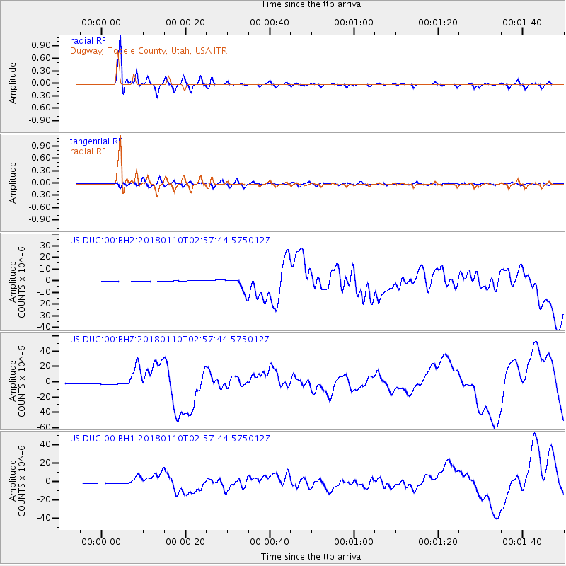
Signal To Noise
| Channel | StoN | STA | LTA |
| US:DUG:00:BHZ:20180110T02:57:44.575012Z | 3.1457205 | 1.3660228E-6 | 4.3424797E-7 |
| US:DUG:00:BH1:20180110T02:57:44.575012Z | 3.5177035 | 6.7388737E-7 | 1.9157027E-7 |
| US:DUG:00:BH2:20180110T02:57:44.575012Z | 3.5828118 | 9.597507E-7 | 2.678764E-7 |
| Arrivals |
| Ps | |
| PpPs | |
| PsPs/PpSs | |


