You are here: Home > Network List > UU - University of Utah Regional Network Stations List
> Station FOR4 Blundell West, UT, USA > Earthquake Result Viewer
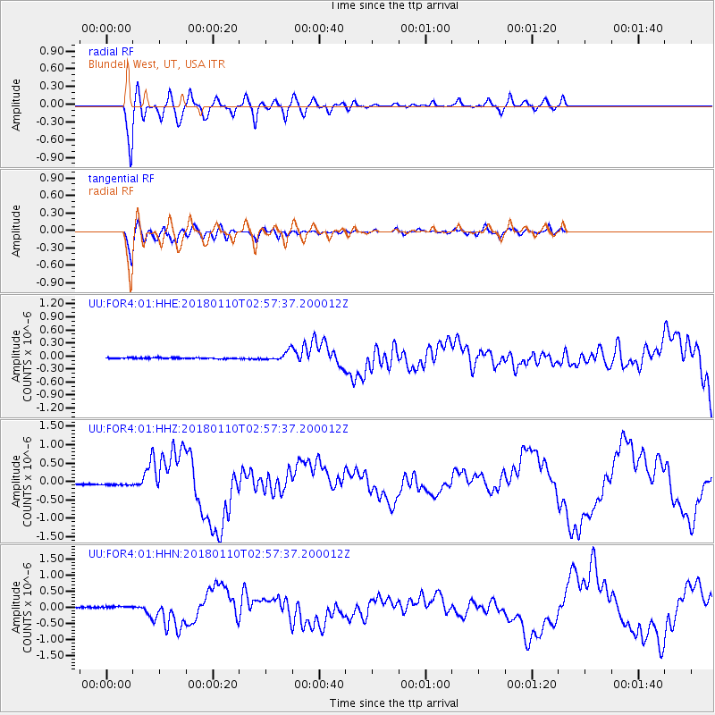
FOR4 Blundell West, UT, USA - Earthquake Result Viewer
*The percent match for this event was below the threshold and hence no stack was calculated.
| Earthquake location: |
North Of Honduras |
| Earthquake latitude/longitude: |
17.5/-83.6 |
| Earthquake time(UTC): |
2018/01/10 (010) 02:51:31 GMT |
| Earthquake Depth: |
33 km |
| Earthquake Magnitude: |
7.8 Mi |
| Earthquake Catalog/Contributor: |
NEIC PDE/pt |
|
| Network: |
UU University of Utah Regional Network |
| Station: |
FOR4 Blundell West, UT, USA |
| Lat/Lon: |
38.50 N/112.90 W |
| Elevation: |
1657 m |
|
| Distance: |
33.1 deg |
| Az: |
315.198 deg |
| Baz: |
121.02 deg |
| Ray Param: |
$rayparam |
*The percent match for this event was below the threshold and hence was not used in the summary stack. |
|
| Radial Match: |
91.08831 % |
| Radial Bump: |
400 |
| Transverse Match: |
90.96461 % |
| Transverse Bump: |
400 |
| SOD ConfigId: |
2973751 |
| Insert Time: |
2018-10-09 05:31:09.757 +0000 |
| GWidth: |
2.5 |
| Max Bumps: |
400 |
| Tol: |
0.001 |
|
Signal To Noise
| Channel | StoN | STA | LTA |
| UU:FOR4:01:HHZ:20180110T02:57:37.200012Z | 2.6553571 | 4.794216E-8 | 1.8054882E-8 |
| UU:FOR4:01:HHN:20180110T02:57:37.200012Z | 2.4758785 | 4.2280767E-8 | 1.7077078E-8 |
| UU:FOR4:01:HHE:20180110T02:57:37.200012Z | 2.105488 | 2.2402725E-8 | 1.0640157E-8 |
| Arrivals |
| Ps | |
| PpPs | |
| PsPs/PpSs | |


