You are here: Home > Network List > UU - University of Utah Regional Network Stations List
> Station FORU South Mineral Mountains, UT, USA > Earthquake Result Viewer
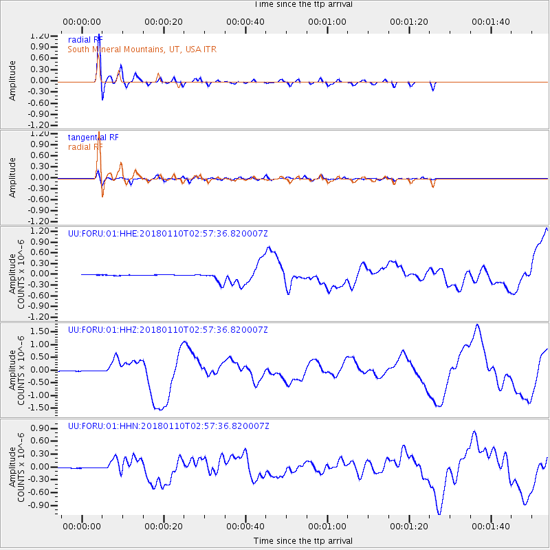
FORU South Mineral Mountains, UT, USA - Earthquake Result Viewer
*The percent match for this event was below the threshold and hence no stack was calculated.
| Earthquake location: |
North Of Honduras |
| Earthquake latitude/longitude: |
17.5/-83.6 |
| Earthquake time(UTC): |
2018/01/10 (010) 02:51:31 GMT |
| Earthquake Depth: |
33 km |
| Earthquake Magnitude: |
7.8 Mi |
| Earthquake Catalog/Contributor: |
NEIC PDE/pt |
|
| Network: |
UU University of Utah Regional Network |
| Station: |
FORU South Mineral Mountains, UT, USA |
| Lat/Lon: |
38.46 N/112.86 W |
| Elevation: |
1840 m |
|
| Distance: |
33.0 deg |
| Az: |
315.161 deg |
| Baz: |
121.011 deg |
| Ray Param: |
$rayparam |
*The percent match for this event was below the threshold and hence was not used in the summary stack. |
|
| Radial Match: |
95.38282 % |
| Radial Bump: |
394 |
| Transverse Match: |
76.986206 % |
| Transverse Bump: |
400 |
| SOD ConfigId: |
2973751 |
| Insert Time: |
2018-10-09 05:31:12.377 +0000 |
| GWidth: |
2.5 |
| Max Bumps: |
400 |
| Tol: |
0.001 |
|
Signal To Noise
| Channel | StoN | STA | LTA |
| UU:FORU:01:HHZ:20180110T02:57:36.820007Z | 0.88055253 | 6.4454664E-9 | 7.3197977E-9 |
| UU:FORU:01:HHN:20180110T02:57:36.820007Z | 1.7509081 | 4.8246087E-9 | 2.7554892E-9 |
| UU:FORU:01:HHE:20180110T02:57:36.820007Z | 1.2322781 | 9.482704E-9 | 7.695263E-9 |
| Arrivals |
| Ps | |
| PpPs | |
| PsPs/PpSs | |


