You are here: Home > Network List > TA - USArray Transportable Network (new EarthScope stations) Stations List
> Station Q28A Sharon Springs, KS, USA > Earthquake Result Viewer
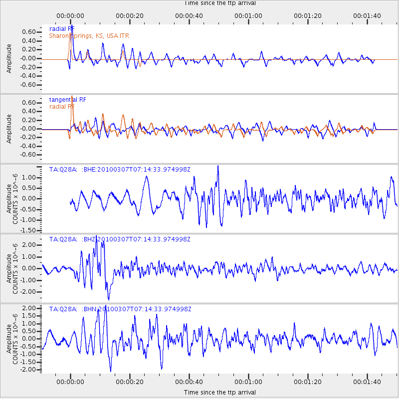
Q28A Sharon Springs, KS, USA - Earthquake Result Viewer
*The percent match for this event was below the threshold and hence no stack was calculated.
| Earthquake location: |
Southern East Pacific Rise |
| Earthquake latitude/longitude: |
-16.2/-115.3 |
| Earthquake time(UTC): |
2010/03/07 (066) 07:05:23 GMT |
| Earthquake Depth: |
10 km |
| Earthquake Magnitude: |
5.8 MB, 5.7 MS, 6.3 MW, 6.2 MW |
| Earthquake Catalog/Contributor: |
WHDF/NEIC |
|
| Network: |
TA USArray Transportable Network (new EarthScope stations) |
| Station: |
Q28A Sharon Springs, KS, USA |
| Lat/Lon: |
39.06 N/101.83 W |
| Elevation: |
1133 m |
|
| Distance: |
56.4 deg |
| Az: |
12.566 deg |
| Baz: |
195.571 deg |
| Ray Param: |
$rayparam |
*The percent match for this event was below the threshold and hence was not used in the summary stack. |
|
| Radial Match: |
72.801735 % |
| Radial Bump: |
400 |
| Transverse Match: |
53.929947 % |
| Transverse Bump: |
400 |
| SOD ConfigId: |
299721 |
| Insert Time: |
2010-04-26 18:05:55.145 +0000 |
| GWidth: |
2.5 |
| Max Bumps: |
400 |
| Tol: |
0.001 |
|
Signal To Noise
| Channel | StoN | STA | LTA |
| TA:Q28A: :BHZ:20100307T07:14:33.974998Z | 3.3947935 | 6.7631805E-7 | 1.9922216E-7 |
| TA:Q28A: :BHN:20100307T07:14:33.974998Z | 1.9734366 | 6.037156E-7 | 3.0592096E-7 |
| TA:Q28A: :BHE:20100307T07:14:33.974998Z | 1.0384307 | 3.0180055E-7 | 2.9063142E-7 |
| Arrivals |
| Ps | |
| PpPs | |
| PsPs/PpSs | |


