You are here: Home > Network List > AV - Alaska Volcano Observatory Stations List
> Station MAPS Pakushin Southeast, Makushin Volcano, Alaska > Earthquake Result Viewer
MAPS Pakushin Southeast, Makushin Volcano, Alaska - Earthquake Result Viewer
*The percent match for this event was below the threshold and hence no stack was calculated.
| Earthquake location: |
Guerrero, Mexico |
| Earthquake latitude/longitude: |
17.2/-100.5 |
| Earthquake time(UTC): |
2022/12/11 (345) 14:31:29 GMT |
| Earthquake Depth: |
18 km |
| Earthquake Magnitude: |
6.0 mww |
| Earthquake Catalog/Contributor: |
NEIC PDE/us |
|
| Network: |
AV Alaska Volcano Observatory |
| Station: |
MAPS Pakushin Southeast, Makushin Volcano, Alaska |
| Lat/Lon: |
53.81 N/166.94 W |
| Elevation: |
333 m |
|
| Distance: |
62.4 deg |
| Az: |
322.163 deg |
| Baz: |
98.646 deg |
| Ray Param: |
$rayparam |
*The percent match for this event was below the threshold and hence was not used in the summary stack. |
|
| Radial Match: |
52.521187 % |
| Radial Bump: |
400 |
| Transverse Match: |
56.56967 % |
| Transverse Bump: |
400 |
| SOD ConfigId: |
29823551 |
| Insert Time: |
2022-12-25 14:36:57.092 +0000 |
| GWidth: |
2.5 |
| Max Bumps: |
400 |
| Tol: |
0.001 |
|
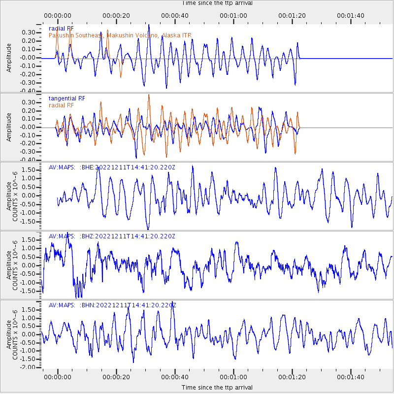
Signal To Noise
| Channel | StoN | STA | LTA |
| AV:MAPS: :BHZ:20221211T14:41:20.220Z | 2.032587 | 1.2305503E-6 | 6.054109E-7 |
| AV:MAPS: :BHN:20221211T14:41:20.220Z | 0.7793248 | 4.6590418E-7 | 5.9783054E-7 |
| AV:MAPS: :BHE:20221211T14:41:20.220Z | 1.4162652 | 9.769769E-7 | 6.8982627E-7 |
| Arrivals |
| Ps | |
| PpPs | |
| PsPs/PpSs | |


