You are here: Home > Network List > UW - Pacific Northwest Regional Seismic Network Stations List
> Station UMAT Pilot Rock, OR, USA > Earthquake Result Viewer
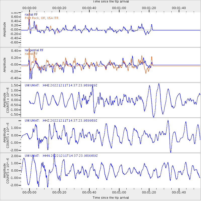
UMAT Pilot Rock, OR, USA - Earthquake Result Viewer
*The percent match for this event was below the threshold and hence no stack was calculated.
| Earthquake location: |
Guerrero, Mexico |
| Earthquake latitude/longitude: |
17.2/-100.5 |
| Earthquake time(UTC): |
2022/12/11 (345) 14:31:29 GMT |
| Earthquake Depth: |
18 km |
| Earthquake Magnitude: |
6.0 mww |
| Earthquake Catalog/Contributor: |
NEIC PDE/us |
|
| Network: |
UW Pacific Northwest Regional Seismic Network |
| Station: |
UMAT Pilot Rock, OR, USA |
| Lat/Lon: |
45.29 N/118.96 W |
| Elevation: |
1318 m |
|
| Distance: |
32.0 deg |
| Az: |
335.035 deg |
| Baz: |
145.144 deg |
| Ray Param: |
$rayparam |
*The percent match for this event was below the threshold and hence was not used in the summary stack. |
|
| Radial Match: |
63.588364 % |
| Radial Bump: |
345 |
| Transverse Match: |
78.93244 % |
| Transverse Bump: |
397 |
| SOD ConfigId: |
29823551 |
| Insert Time: |
2022-12-25 14:50:12.863 +0000 |
| GWidth: |
2.5 |
| Max Bumps: |
400 |
| Tol: |
0.001 |
|
Signal To Noise
| Channel | StoN | STA | LTA |
| UW:UMAT: :HHZ:20221211T14:37:23.989989Z | 1.7140586 | 7.3746617E-7 | 4.302456E-7 |
| UW:UMAT: :HHN:20221211T14:37:23.989989Z | 1.7109265 | 1.3716657E-6 | 8.017093E-7 |
| UW:UMAT: :HHE:20221211T14:37:23.989989Z | 1.2086495 | 5.6886284E-7 | 4.7065987E-7 |
| Arrivals |
| Ps | |
| PpPs | |
| PsPs/PpSs | |


