You are here: Home > Network List > TA - USArray Transportable Network (new EarthScope stations) Stations List
> Station Z33A Whitaker Ranch, Olney, TX, USA > Earthquake Result Viewer
Z33A Whitaker Ranch, Olney, TX, USA - Earthquake Result Viewer

| Earthquake location: |
Southern East Pacific Rise |
| Earthquake latitude/longitude: |
-16.2/-115.3 |
| Earthquake time(UTC): |
2010/03/07 (066) 07:05:23 GMT |
| Earthquake Depth: |
10 km |
| Earthquake Magnitude: |
5.8 MB, 5.7 MS, 6.3 MW, 6.2 MW |
| Earthquake Catalog/Contributor: |
WHDF/NEIC |
|
| Network: |
TA USArray Transportable Network (new EarthScope stations) |
| Station: |
Z33A Whitaker Ranch, Olney, TX, USA |
| Lat/Lon: |
33.29 N/98.76 W |
| Elevation: |
362 m |
|
| Distance: |
51.7 deg |
| Az: |
17.676 deg |
| Baz: |
200.377 deg |
| Ray Param: |
0.06722863 |
| Estimated Moho Depth: |
47.75 km |
| Estimated Crust Vp/Vs: |
1.61 |
| Assumed Crust Vp: |
6.426 km/s |
| Estimated Crust Vs: |
4.004 km/s |
| Estimated Crust Poisson's Ratio: |
0.18 |
|
| Radial Match: |
85.70635 % |
| Radial Bump: |
368 |
| Transverse Match: |
58.950638 % |
| Transverse Bump: |
379 |
| SOD ConfigId: |
299721 |
| Insert Time: |
2010-04-26 18:14:17.109 +0000 |
| GWidth: |
2.5 |
| Max Bumps: |
400 |
| Tol: |
0.001 |
|
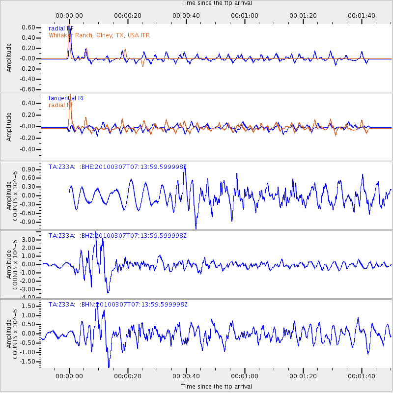
Signal To Noise
| Channel | StoN | STA | LTA |
| TA:Z33A: :BHZ:20100307T07:13:59.599998Z | 3.9723895 | 7.1229596E-7 | 1.7931171E-7 |
| TA:Z33A: :BHN:20100307T07:13:59.599998Z | 2.323532 | 3.6082946E-7 | 1.5529352E-7 |
| TA:Z33A: :BHE:20100307T07:13:59.599998Z | 0.8058171 | 2.0743698E-7 | 2.574244E-7 |
| Arrivals |
| Ps | 4.8 SECOND |
| PpPs | 18 SECOND |
| PsPs/PpSs | 23 SECOND |


