You are here: Home > Network List > US - United States National Seismic Network Stations List
> Station MNTX Cornudas Mountains, Texas, USA > Earthquake Result Viewer
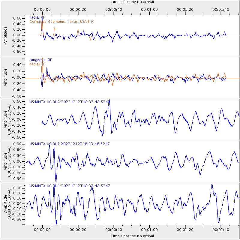
MNTX Cornudas Mountains, Texas, USA - Earthquake Result Viewer
*The percent match for this event was below the threshold and hence no stack was calculated.
| Earthquake location: |
South Of Panama |
| Earthquake latitude/longitude: |
4.8/-82.8 |
| Earthquake time(UTC): |
2022/12/12 (346) 18:27:34 GMT |
| Earthquake Depth: |
10 km |
| Earthquake Magnitude: |
5.5 mww |
| Earthquake Catalog/Contributor: |
NEIC PDE/us |
|
| Network: |
US United States National Seismic Network |
| Station: |
MNTX Cornudas Mountains, Texas, USA |
| Lat/Lon: |
31.70 N/105.38 W |
| Elevation: |
405 m |
|
| Distance: |
34.1 deg |
| Az: |
324.226 deg |
| Baz: |
136.89 deg |
| Ray Param: |
$rayparam |
*The percent match for this event was below the threshold and hence was not used in the summary stack. |
|
| Radial Match: |
73.843925 % |
| Radial Bump: |
376 |
| Transverse Match: |
75.403625 % |
| Transverse Bump: |
400 |
| SOD ConfigId: |
29823551 |
| Insert Time: |
2022-12-26 18:51:08.787 +0000 |
| GWidth: |
2.5 |
| Max Bumps: |
400 |
| Tol: |
0.001 |
|
Signal To Noise
| Channel | StoN | STA | LTA |
| US:MNTX:00:BHZ:20221212T18:33:48.524Z | 1.8293577 | 3.431102E-7 | 1.8755775E-7 |
| US:MNTX:00:BH1:20221212T18:33:48.524Z | 0.9794712 | 9.797133E-8 | 1.00024714E-7 |
| US:MNTX:00:BH2:20221212T18:33:48.524Z | 3.1581187 | 3.3513703E-7 | 1.06119195E-7 |
| Arrivals |
| Ps | |
| PpPs | |
| PsPs/PpSs | |


