You are here: Home > Network List > US - United States National Seismic Network Stations List
> Station HAWA Hanford, Washington, USA > Earthquake Result Viewer
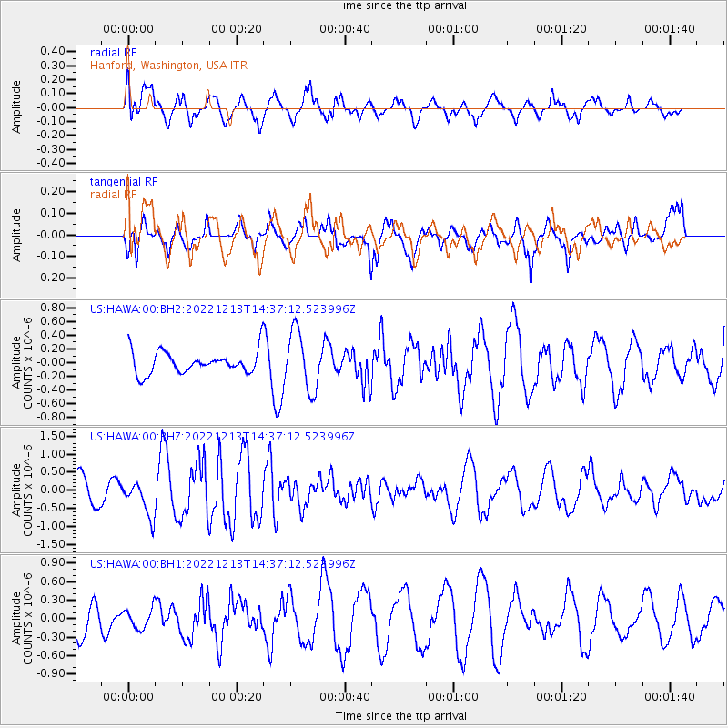
HAWA Hanford, Washington, USA - Earthquake Result Viewer
*The percent match for this event was below the threshold and hence no stack was calculated.
| Earthquake location: |
Ryukyu Islands, Japan |
| Earthquake latitude/longitude: |
27.5/129.6 |
| Earthquake time(UTC): |
2022/12/13 (347) 14:25:15 GMT |
| Earthquake Depth: |
10 km |
| Earthquake Magnitude: |
5.7 mww |
| Earthquake Catalog/Contributor: |
NEIC PDE/us |
|
| Network: |
US United States National Seismic Network |
| Station: |
HAWA Hanford, Washington, USA |
| Lat/Lon: |
46.39 N/119.53 W |
| Elevation: |
364 m |
|
| Distance: |
83.5 deg |
| Az: |
40.591 deg |
| Baz: |
303.402 deg |
| Ray Param: |
$rayparam |
*The percent match for this event was below the threshold and hence was not used in the summary stack. |
|
| Radial Match: |
69.86159 % |
| Radial Bump: |
400 |
| Transverse Match: |
56.354744 % |
| Transverse Bump: |
358 |
| SOD ConfigId: |
29823551 |
| Insert Time: |
2022-12-27 14:45:23.820 +0000 |
| GWidth: |
2.5 |
| Max Bumps: |
400 |
| Tol: |
0.001 |
|
Signal To Noise
| Channel | StoN | STA | LTA |
| US:HAWA:00:BHZ:20221213T14:37:12.523996Z | 1.2615103 | 4.8606836E-7 | 3.8530672E-7 |
| US:HAWA:00:BH1:20221213T14:37:12.523996Z | 0.48600248 | 1.6214256E-7 | 3.3362497E-7 |
| US:HAWA:00:BH2:20221213T14:37:12.523996Z | 2.7353692 | 4.3967506E-7 | 1.60737E-7 |
| Arrivals |
| Ps | |
| PpPs | |
| PsPs/PpSs | |


