You are here: Home > Network List > TA - USArray Transportable Network (new EarthScope stations) Stations List
> Station U23A El Rito, NM, USA > Earthquake Result Viewer
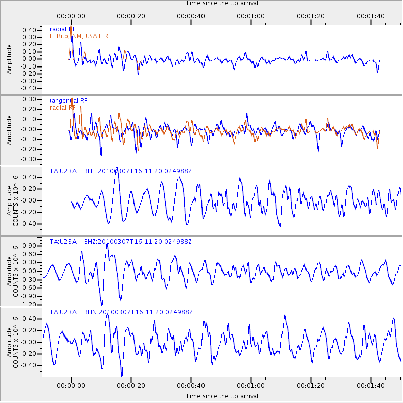
U23A El Rito, NM, USA - Earthquake Result Viewer
*The percent match for this event was below the threshold and hence no stack was calculated.
| Earthquake location: |
Near Coast Of Central Chile |
| Earthquake latitude/longitude: |
-38.0/-73.3 |
| Earthquake time(UTC): |
2010/03/07 (066) 15:59:44 GMT |
| Earthquake Depth: |
27 km |
| Earthquake Magnitude: |
5.5 MB, 5.6 MS, 5.8 MW, 5.8 MW |
| Earthquake Catalog/Contributor: |
WHDF/NEIC |
|
| Network: |
TA USArray Transportable Network (new EarthScope stations) |
| Station: |
U23A El Rito, NM, USA |
| Lat/Lon: |
36.33 N/106.19 W |
| Elevation: |
2093 m |
|
| Distance: |
80.0 deg |
| Az: |
333.555 deg |
| Baz: |
154.168 deg |
| Ray Param: |
$rayparam |
*The percent match for this event was below the threshold and hence was not used in the summary stack. |
|
| Radial Match: |
61.96564 % |
| Radial Bump: |
400 |
| Transverse Match: |
54.87763 % |
| Transverse Bump: |
400 |
| SOD ConfigId: |
299721 |
| Insert Time: |
2010-04-26 18:27:52.047 +0000 |
| GWidth: |
2.5 |
| Max Bumps: |
400 |
| Tol: |
0.001 |
|
Signal To Noise
| Channel | StoN | STA | LTA |
| TA:U23A: :BHZ:20100307T16:11:20.024988Z | 2.2400744 | 3.2814677E-7 | 1.4648924E-7 |
| TA:U23A: :BHN:20100307T16:11:20.024988Z | 0.57267374 | 1.06599515E-7 | 1.8614352E-7 |
| TA:U23A: :BHE:20100307T16:11:20.024988Z | 1.1753273 | 2.3313629E-7 | 1.9835862E-7 |
| Arrivals |
| Ps | |
| PpPs | |
| PsPs/PpSs | |


