You are here: Home > Network List > TA - USArray Transportable Network (new EarthScope stations) Stations List
> Station S26A Kim, CO, USA > Earthquake Result Viewer
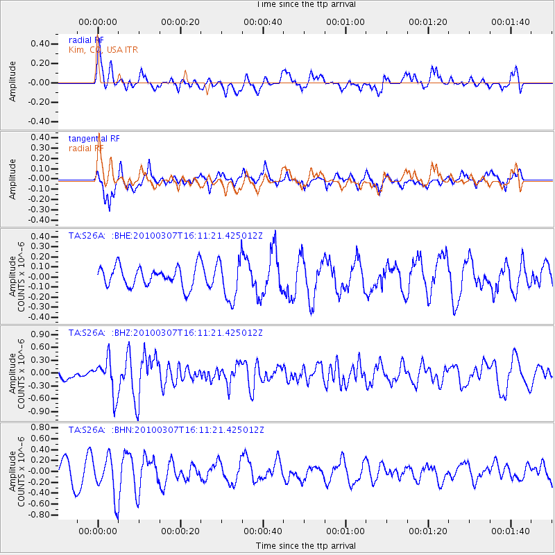
S26A Kim, CO, USA - Earthquake Result Viewer
*The percent match for this event was below the threshold and hence no stack was calculated.
| Earthquake location: |
Near Coast Of Central Chile |
| Earthquake latitude/longitude: |
-38.0/-73.3 |
| Earthquake time(UTC): |
2010/03/07 (066) 15:59:44 GMT |
| Earthquake Depth: |
27 km |
| Earthquake Magnitude: |
5.5 MB, 5.6 MS, 5.8 MW, 5.8 MW |
| Earthquake Catalog/Contributor: |
WHDF/NEIC |
|
| Network: |
TA USArray Transportable Network (new EarthScope stations) |
| Station: |
S26A Kim, CO, USA |
| Lat/Lon: |
37.62 N/103.47 W |
| Elevation: |
1394 m |
|
| Distance: |
80.2 deg |
| Az: |
336.112 deg |
| Baz: |
156.237 deg |
| Ray Param: |
$rayparam |
*The percent match for this event was below the threshold and hence was not used in the summary stack. |
|
| Radial Match: |
45.292103 % |
| Radial Bump: |
399 |
| Transverse Match: |
76.65218 % |
| Transverse Bump: |
400 |
| SOD ConfigId: |
299721 |
| Insert Time: |
2010-04-26 18:32:17.428 +0000 |
| GWidth: |
2.5 |
| Max Bumps: |
400 |
| Tol: |
0.001 |
|
Signal To Noise
| Channel | StoN | STA | LTA |
| TA:S26A: :BHZ:20100307T16:11:21.425012Z | 3.1708848 | 4.3266388E-7 | 1.3644893E-7 |
| TA:S26A: :BHN:20100307T16:11:21.425012Z | 2.7973208 | 3.7436854E-7 | 1.3383111E-7 |
| TA:S26A: :BHE:20100307T16:11:21.425012Z | 2.1377666 | 2.131954E-7 | 9.97281E-8 |
| Arrivals |
| Ps | |
| PpPs | |
| PsPs/PpSs | |


