You are here: Home > Network List > IC - New China Digital Seismograph Network Stations List
> Station KMI Kunming, Yunnan Province, China > Earthquake Result Viewer
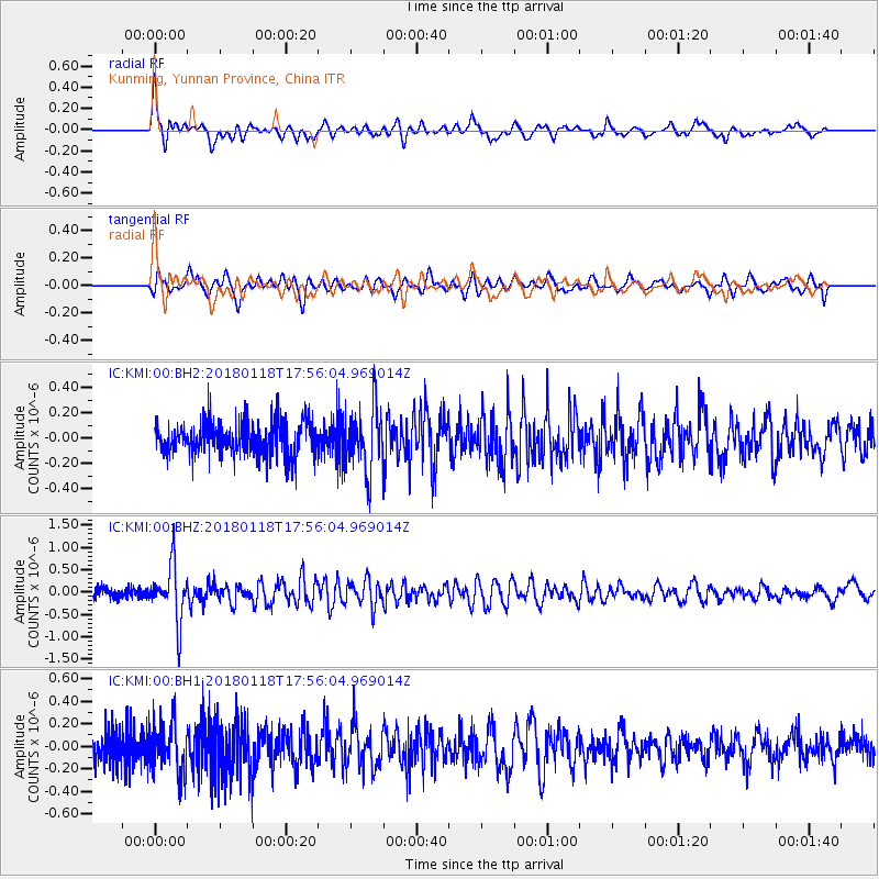
KMI Kunming, Yunnan Province, China - Earthquake Result Viewer
*The percent match for this event was below the threshold and hence no stack was calculated.
| Earthquake location: |
Tanimbar Islands Reg., Indonesia |
| Earthquake latitude/longitude: |
-6.4/132.8 |
| Earthquake time(UTC): |
2018/01/18 (018) 17:48:39 GMT |
| Earthquake Depth: |
27 km |
| Earthquake Magnitude: |
5.6 Mww |
| Earthquake Catalog/Contributor: |
NEIC PDE/us |
|
| Network: |
IC New China Digital Seismograph Network |
| Station: |
KMI Kunming, Yunnan Province, China |
| Lat/Lon: |
25.12 N/102.74 E |
| Elevation: |
1975 m |
|
| Distance: |
42.9 deg |
| Az: |
318.128 deg |
| Baz: |
132.963 deg |
| Ray Param: |
$rayparam |
*The percent match for this event was below the threshold and hence was not used in the summary stack. |
|
| Radial Match: |
67.34018 % |
| Radial Bump: |
400 |
| Transverse Match: |
65.01086 % |
| Transverse Bump: |
400 |
| SOD ConfigId: |
2973751 |
| Insert Time: |
2018-10-09 06:02:22.220 +0000 |
| GWidth: |
2.5 |
| Max Bumps: |
400 |
| Tol: |
0.001 |
|
Signal To Noise
| Channel | StoN | STA | LTA |
| IC:KMI:00:BHZ:20180118T17:56:04.969014Z | 6.164866 | 6.2459236E-7 | 1.01314825E-7 |
| IC:KMI:00:BH1:20180118T17:56:04.969014Z | 1.5521865 | 2.2153532E-7 | 1.4272469E-7 |
| IC:KMI:00:BH2:20180118T17:56:04.969014Z | 1.9018248 | 2.5437717E-7 | 1.3375426E-7 |
| Arrivals |
| Ps | |
| PpPs | |
| PsPs/PpSs | |


