You are here: Home > Network List > TA - USArray Transportable Network (new EarthScope stations) Stations List
> Station S30A Montezuma, KS, USA > Earthquake Result Viewer
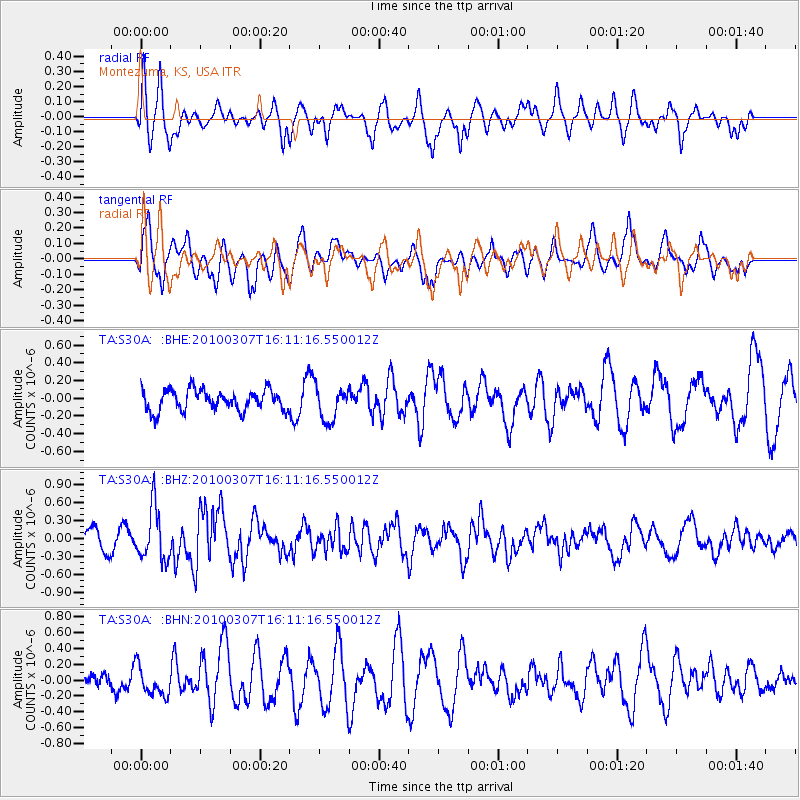
S30A Montezuma, KS, USA - Earthquake Result Viewer
*The percent match for this event was below the threshold and hence no stack was calculated.
| Earthquake location: |
Near Coast Of Central Chile |
| Earthquake latitude/longitude: |
-38.0/-73.3 |
| Earthquake time(UTC): |
2010/03/07 (066) 15:59:44 GMT |
| Earthquake Depth: |
27 km |
| Earthquake Magnitude: |
5.5 MB, 5.6 MS, 5.8 MW, 5.8 MW |
| Earthquake Catalog/Contributor: |
WHDF/NEIC |
|
| Network: |
TA USArray Transportable Network (new EarthScope stations) |
| Station: |
S30A Montezuma, KS, USA |
| Lat/Lon: |
37.64 N/100.46 W |
| Elevation: |
853 m |
|
| Distance: |
79.3 deg |
| Az: |
338.358 deg |
| Baz: |
158.465 deg |
| Ray Param: |
$rayparam |
*The percent match for this event was below the threshold and hence was not used in the summary stack. |
|
| Radial Match: |
63.49049 % |
| Radial Bump: |
397 |
| Transverse Match: |
66.755135 % |
| Transverse Bump: |
400 |
| SOD ConfigId: |
299721 |
| Insert Time: |
2010-04-26 18:37:42.277 +0000 |
| GWidth: |
2.5 |
| Max Bumps: |
400 |
| Tol: |
0.001 |
|
Signal To Noise
| Channel | StoN | STA | LTA |
| TA:S30A: :BHZ:20100307T16:11:16.550012Z | 2.3508596 | 4.3583807E-7 | 1.8539518E-7 |
| TA:S30A: :BHN:20100307T16:11:16.550012Z | 0.9954703 | 1.8545607E-7 | 1.8629996E-7 |
| TA:S30A: :BHE:20100307T16:11:16.550012Z | 1.6170985 | 1.9159873E-7 | 1.1848303E-7 |
| Arrivals |
| Ps | |
| PpPs | |
| PsPs/PpSs | |


