You are here: Home > Network List > US - United States National Seismic Network Stations List
> Station CBKS Cedar Bluff, Kansas, USA > Earthquake Result Viewer
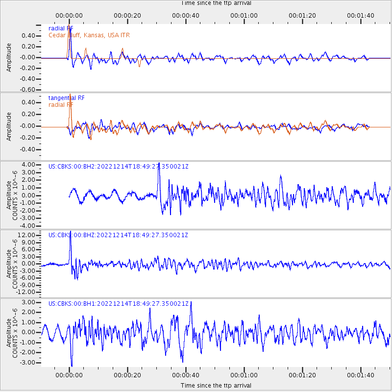
CBKS Cedar Bluff, Kansas, USA - Earthquake Result Viewer
*The percent match for this event was below the threshold and hence no stack was calculated.
| Earthquake location: |
Rat Islands, Aleutian Islands |
| Earthquake latitude/longitude: |
51.6/178.6 |
| Earthquake time(UTC): |
2022/12/14 (348) 18:40:26 GMT |
| Earthquake Depth: |
73 km |
| Earthquake Magnitude: |
6.3 Mww |
| Earthquake Catalog/Contributor: |
NEIC PDE/us |
|
| Network: |
US United States National Seismic Network |
| Station: |
CBKS Cedar Bluff, Kansas, USA |
| Lat/Lon: |
38.81 N/99.74 W |
| Elevation: |
677 m |
|
| Distance: |
56.0 deg |
| Az: |
68.76 deg |
| Baz: |
311.944 deg |
| Ray Param: |
$rayparam |
*The percent match for this event was below the threshold and hence was not used in the summary stack. |
|
| Radial Match: |
69.31422 % |
| Radial Bump: |
400 |
| Transverse Match: |
48.7259 % |
| Transverse Bump: |
400 |
| SOD ConfigId: |
29823551 |
| Insert Time: |
2022-12-28 19:22:27.905 +0000 |
| GWidth: |
2.5 |
| Max Bumps: |
400 |
| Tol: |
0.001 |
|
Signal To Noise
| Channel | StoN | STA | LTA |
| US:CBKS:00:BHZ:20221214T18:49:27.350021Z | 12.743379 | 4.4782532E-6 | 3.5141807E-7 |
| US:CBKS:00:BH1:20221214T18:49:27.350021Z | 2.1237218 | 1.1834113E-6 | 5.572346E-7 |
| US:CBKS:00:BH2:20221214T18:49:27.350021Z | 3.6544132 | 1.731837E-6 | 4.739029E-7 |
| Arrivals |
| Ps | |
| PpPs | |
| PsPs/PpSs | |


